




Colorado River Timeline
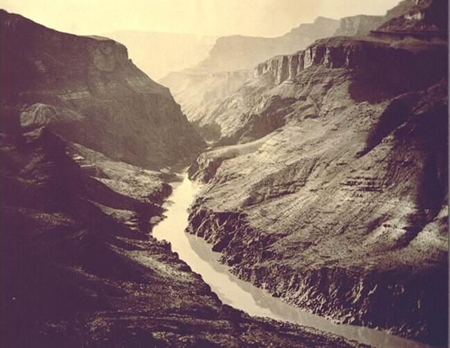 Circa
600 Ancestral Puebloan and Hohokam people develop
sophisticated water distribution systems.
Circa
600 Ancestral Puebloan and Hohokam people develop
sophisticated water distribution systems.
1500 Spanish explorers introduce ditch systems called acequias.
1869-71 John Wesley Powell makes two explorations of the Colorado River by wooden rowboat.
1892 Colorado River water delivered across Continental Divide into Eastern Colorado through the Grand Ditch – the river’s first transbasin diversion project.
1901 California Development Co. diverts Colorado River water into Imperial Valley.
1902 U.S. Reclamation Service (Bureau of Reclamation) established.
1905-07 Colorado River breaks through Imperial Valley Canal, flowing into ancient Lake Cahuilla to form what is now called the Salton Sea.
1908 In the Winters v. U.S. decision, Supreme Court rules that the treaties creating reservations for Native American tribes convey a right not only to land, but to water as well.
1919 Grand Canyon National Park created, with the mainstem of the Colorado at the bottom.
1922 Representatives from the seven Colorado River Basin states negotiate the Colorado River Compact.
1923 With the exception of Arizona, the Basin states ratify the Compact.
1928 Congress approves the Compact and passes the Boulder Canyon Project Act, authorizing construction of Hoover Dam and the All-American Canal.
The Metropolitan Water District of Southern California (MWD) is formed to build the Colorado River Aqueduct across the Mojave Desert to Southern California.
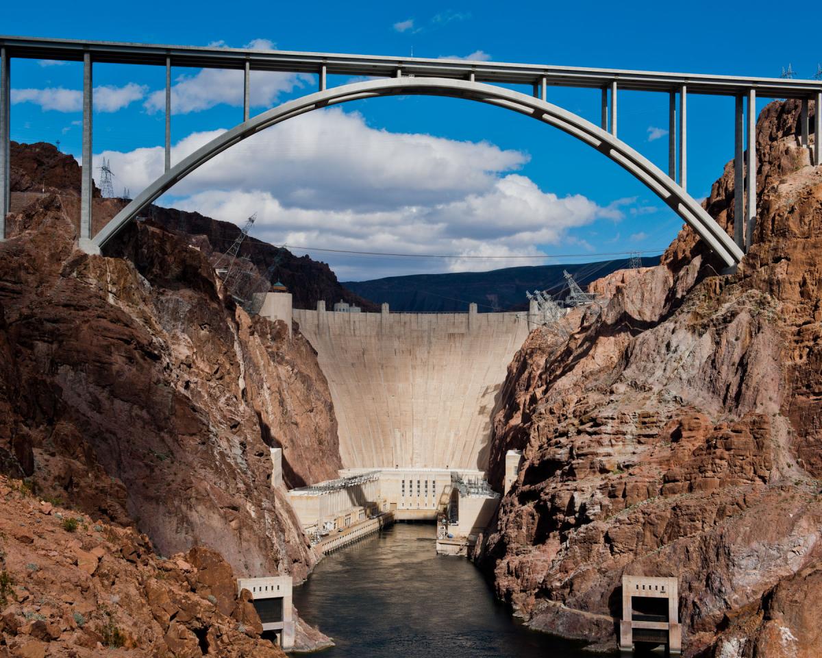 1931 Construction of Hoover Dam begins.
1937 Congress authorizes the Colorado-Big Thompson Project to channel Colorado River water across the Continental Divide to the Colorado Front Range.
1940 Reclamation completes All-American Canal.
1941 MWD completes 242-mile-long Colorado River Aqueduct.
1944 U.S. and Mexico sign treaty to annually allocate 1.5 million acre-feet of Colorado River water to Mexico.
After 22 years of opposition, Arizona Legislature ratifies Colorado River Compact.
1948 Colorado, Wyoming, Utah and New Mexico sign Upper Colorado River Compact apportioning water among themselves and paving the way for new water projects.
1952 Federal bill for Upper Basin projects generates national opposition because the proposed Echo Park Dam would flood Dinosaur National Monument.
1956 With Echo Park Dam removed from consideration, Colorado River Storage Project Act approves multiple projects in the Upper Basin, including Flaming Gorge Dam and Glen Canyon Dam.
1963 Glen Canyon Dam completed.
1964 U.S. Supreme Court decree in Arizona v. California holds California to 4.4 million, Arizona to 2.8 million and Nevada to 300,000 acre-feet annually, as provided in the Boulder Canyon Project Act.
1968 Congress passes Colorado River Basin Project Act, authorizing construction of the Central Arizona Project (CAP). A proposal to build Bridge Canyon Dam within the Grand Canyon is removed after one of biggest environmental battles in U.S. history.
1973 Mexico and U.S. approve Minute 242, a supplement to their 1944 Water Treaty, establishing salinity standards for water delivered to Mexico.
Construction begins on CAP.
1974 Congress approves Colorado River Basin Salinity Control Act, authorizing basinwide salinity control projects and construction of a desalination plant near Yuma, Arizona.
1985 CAP begins operation.
1988 Upper Basin states launch the Upper Colorado River Endangered Fish Recovery Program.
MWD agrees to fund efficiency improvements in the Imperial Irrigation District (IID) in exchange for roughly 100,000 acre-feet of conserved water per year.
1991 Southern Nevada Water Authority (SNWA) formed.
1992 Congress passes the Grand Canyon Protection Act, requiring water releases from Glen Canyon Dam to meet environmental, tribal, cultural and recreational needs.
Yuma desalination plant begins limited operation.
Ten Tribes Colorado River Basin Partnership formed.
1993 CAP declared substantially complete, delivering water to Tucson, Phoenix, Arizona farmers and American Indian Tribes.
1996 Reclamation adopts new operating criteria that include periodic high-flow releases from Glen Canyon Dam into the Grand Canyon to restore riparian habitat and improve fish habitat.
Interior secretary orders California to implement plan to reduce its average use of 5.2 million acre-feet of Colorado River water to “live within” its 4.4 million acre-feet annual basic apportionment.
1998 San Diego County Water Authority (SDCWA) agrees to pay IID for up to 200,000 acre-feet of conserved water per year for up to 75 years.
1999 Interior secretary approves rules allowing Lower Basin states to “bank” water in Arizona aquifers.
2000 The “Millennium Drought” begins on the Colorado River, which will prove to be the worst drought on the river in at least 1,200 years.
2001 Interim Surplus Guidelines signed, providing clarity about how surplus water in the Lower Basin is allocated.
Arizona and Nevada reach water banking agreement.
2003 Quantification Settlement Agreement signed, enabling water transfer between IID and SDCWA and gradual reduction of California use to its Compact apportionment of 4.4 million acre-feet.
Construction begins on Animas-La Plata Project in southwest Colorado, dubbed “the last big dam in the West.”
2004 MWD and Palo Verde Irrigation District sign a 35-year deal to pay farmers to fallow their fields on a rotating basis and transfer the conserved water to urban Southern California.
Gila River Indian Community and Tohono O’odham Nation receive water through the Arizona Water Settlements Act.
2005 Lower Basin Multi-Species Conservation Program signed, launching a 50-year agreement to restore 8,100 acres of habitat between Hoover Dam and the U.S.-Mexico border.
Mexican business interests and two U.S. environmental groups sue to stop project to line All-American Canal with concrete, saying seepage from unlined canal recharges groundwater on the Mexican side of the border.
2006 Congress passes legislation to waive environmental requirements and orders Interior to proceed with the canal lining and construction of Brock Reservoir in Imperial County.
2007 Seven Colorado River states reach agreement on the “interim surplus guidelines,” a package of measures to help them weather the deepening drought.
2008 SNWA begins construction on a new water intake deep in Lake Mead to allow it to keep pace with dropping water levels.
 2009 All-American Canal lining
completed.
2009 All-American Canal lining
completed.
2010 Following a 7.2 magnitude earthquake, Mexico and U.S. sign Minute 318, an interim agreement that allows Mexico to store part of its allocation in Lake Mead while it repairs damaged infrastructure.
Year-long Yuma Desalination Plant pilot run produces 30,000 acre-feet.
2011 Brock Reservoir completed.
Animas La-Plata Project completed.
2012 Minute 319, another supplement to the U.S.-Mexico water treaty, allows Mexico to store water in Lake Mead and provides for “pulse flows” to help restore the Colorado River Delta.
2014 A pulse flow is released from Mexico’s Morelos Dam downstream into the Colorado River Delta, where conservation groups are working to restore some of what was once more than 2 million acres of riparian habitat and wetlands vital to birds and wildlife.
2017 U.S. and Mexico sign Minute 323, which allows for increased Mexican water conservation and storage in Lake Mead to help offset the effects of drought and prevent a shortage from being triggered. Minute 323 dedicates 210,000 acre-feet of water over nine years for environmental restoration work in the Colorado River Delta.
2018 Bureau of Reclamation releases the Tribal Water Study, its first comprehensive effort to give tribes a more meaningful role in discussions about the river’s future.
California issues 10-year plan to restore Salton Sea.
2019 Interior and the seven Basin states buttress the 2007 interim guidelines with a pair of Drought Contingency Plans to prevent major reservoirs from declining to critically low levels.
2021 First-ever shortage declaration triggered, requiring Arizona, Nevada and Mexico to reduce their take of the river in 2022; those cuts continue in subsequent years.
2022 Inflation Reduction Act provides $4 billion for water conservation and efficiency programs on the Colorado River, much of which is used to buy water and store it in Lake Mead.
2023 Congress allows Colorado River Indian Tribes to lease portions of its river share. U.S. Supreme Court rules against the Navajo Nation, finding the federal government has no obligation to “undertake affirmative steps to secure water” for the tribe.
2024-2026 Negotiations between the seven Colorado River states begin in earnest over a successor agreement to the 2007 interim guidelines and 2019 Drought Contingency Plans, all of which are set to expire in 2026.
Updated June 2026.


