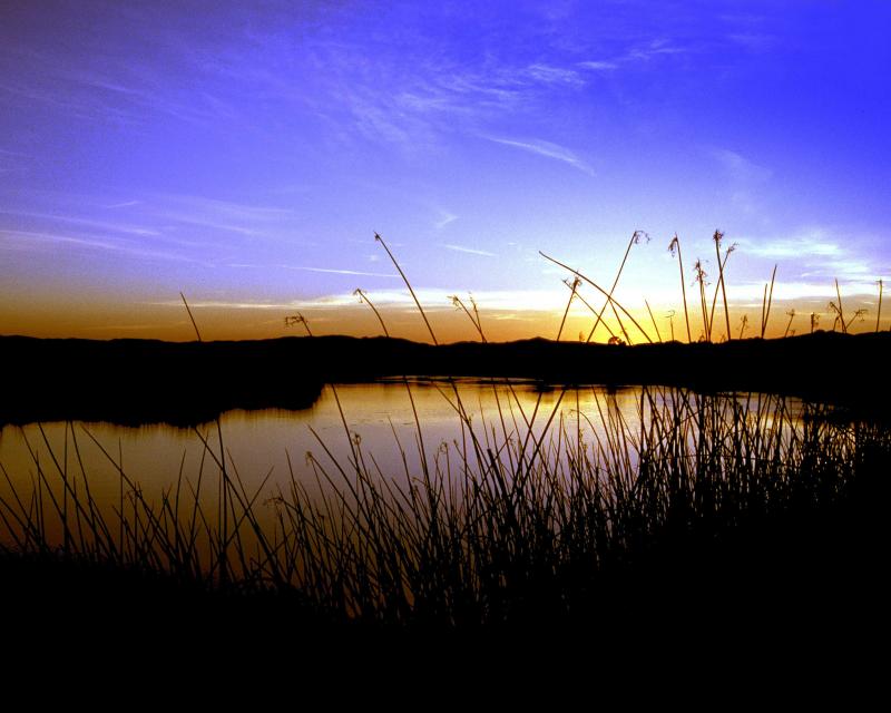
The Sacramento River is California’s
largest river, providing 35 percent of the state’s developed
water supply. The river helps support the valley’s millions of
acres of irrigated agriculture and is home to wildlife and a
range of aquatic species, including rearing habitat for 70
percent of all salmon caught off the California coast.
Once called “the Nile of the West,” the Sacramento River drains
the inland slopes of the Klamath Mountains, the Cascade Range,
the Coast Ranges and the western slopes of the northern Sierra
Nevada. The river stretches some 384 miles from its headwaters
near Mount Shasta to the Sacramento-San Joaquin Delta.
When Californians voted for Proposition 1 in 2014, they had
every reason to expect sound investments in climate-resilient
water projects. And all but one of the projects selected to
receive the proposition’s $2.7 billion in water supply funding
fulfill those criteria.They replenish groundwater basins and
enhance the storage capacity of existing reservoirs to better
withstand droughts — benefits that are realized by all people
across the state. Unfortunately, the one project that does not
measure up — the Sites Reservoir Project — would be publicly
funded to the tune of nearly $900 million. -Written by Max Gomberg, a former California
State Water Resources Control Board climate adviser and a
senior policy consultant and board member of the California
Water Impact Network.
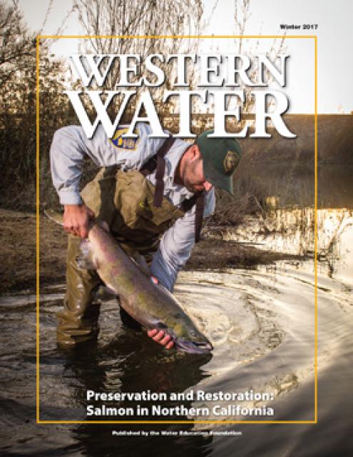
From the Sacramento River to the coast, salmon populations have
struggled to survive, and fishing for salmon in California has
been canceled for the second season in a row, marking the third
season in the state’s history a fishing ban has been in place.
The heart of the problem: dams and climate change. …
Steve Lindley, director of NOAA’s Fisheries Ecology Division at
the Southwest Fisheries Science Center, said
the removal of dams from Oregon to Northern
California on the Klamath will help with survival even if
drought returns.
More people will be cooling off in the waterways as the
temperatures warm up. However, safety officials have a warning.
Officials are calling on people to wear a life jacket on the
river, use heavy duty rafts or raft rentals, be careful of
hidden objects in the river and avoid getting hypothermia as
the river runs colder. “We are fully prepared and fully
staffed for whatever happens,” said Battalion Chief Parker
Wilbourn, with the Sacramento Metropolitan Fire
District. Mostly small crowds enjoyed the American River
this weekend. However as the weather warms up, Wilbourn knows
the crowds will only get bigger, and it’s important to listen
to your body.
For the past two years, Mt. Shasta has emerged from winter
covered in thick blankets of white snow that conceal what
decades of drought have done to the Northern California
mountain’s ancient glaciers. The seasonal snows come and go on
the 14,179-foot peak. For hundreds of years, the glaciers have
clung to the mountain’s steep slopes, slowly changing and
moving over time. But for the past few decades, droughts and
periods of abnormally warm weather have caused the glaciers to
shrink. Scientists have studied the glaciers and documented
their demise as climate change — with its warmer temperatures
and dearth of snow — has slowly caused Mt. Shasta’s glacial
masses to dwindle, especially during the 2020-22 drought.
Since the founding of Sacramento, residents have treasured the
beauty of the American River while living in fear of its
destructive power. Were the American to defy its man-made banks
in a series of historic storms, hundreds of thousands of
residents would face a flood disaster modern-day Sacramento has
never seen. The more we try to tame the river — as when the
Folsom Dam was constructed in 1955 to deny the river its
floodplain — the more we disfigure it. This ugly trade-off has
marked the passage of time in Sacramento and is as central to
the essence of this community as the state Capitol or the Tower
Bridge. A proposal to shore up some erosion spots along the
lower American River is the most recent flashpoint in the
trade-off between public safety and nature. -Written by Tom Philip, Sacramento Bee columnist.
A federal judge denied summary judgment to a California
nonprofit that accuses a solid waste facility in Butte County
of allowing contaminants to seep out of its facility and into a
wetland preserve that leads to a Sacramento River tributary
during a major rainstorm. Nonprofit California Open Lands
maintains a wetland preserve in Butte County that sits near the
Neal Road Recycling and Waste Facility, operated by the Butte
County Department of Public Works.
… The main reason is the decline of the salmon population in
the Sacramento River to such an unsustainable level that
there’s reason to fear that it may not recover for years, if
ever — unless government policies are radically reconsidered.
… The crisis underscores the utter failure of the state’s
political leaders to balance the needs of stakeholders in its
water supply. In this case, the conflict is between large-scale
farms on one side and environmental and fishery interests on
the other. For decades, agribusiness has had the upper
hand in this conflict. -Written by Michael Hiltzik, LA Times columnist.
The governance of San Francisco Bay/Sacramento-San Joaquin
Delta water quality falls under the authority of the State
Water Quality Control Board. Among other duties, the Water
Board is responsible for adopting and updating the Bay-Delta
Water Quality Control Plan for the San Francisco
Bay/Sacramento-San Joaquin Delta Estuary (Bay-Delta
Plan). The Bay-Delta Plan’s purpose sets forth measures
and flow requirements to safeguard various water uses within
the watershed, including municipal, industrial, agricultural,
and ecological needs. Comprising five political appointees with
extensive powers, the Water Board plays a pivotal role in
shaping California’s water management policies. -Written by Cary Keaten, the general manager of
the Solano Irrigation District.
For the second year in a row, there will be no commercial or
recreational salmon fishing in California. … The Golden
State Salmon Association supports the recommendation of the
[Pacific Fishery Management Council], which works closely with
federally recognized West Coast tribes, many who define
themselves as “salmon people” and hold annual ceremonies to
honor their return each year. Bates said $20.6 million has
been allocated from the U.S. Department of Commerce to
compensate for some of the losses caused by last year’s closure
to charter fleets and commercial fleets, buyers and processors.
But the fisheries are calling on the state to allocate water,
not cash. Scott Artis, executive director of the Golden
State Salmon Association, said big agriculture is not limited
in their water use, but fisheries get hit with constraints.
The U.S. Environmental Protection Agency (EPA) today announced
a proposed settlement with Shasta-Siskiyou Transport of
Redding, Calif. to resolve claims of Clean Water Act (CWA)
violations after one of the company’s trucks overturned and a
fuel product spilled into storm drains in downtown Redding. The
fuel reached the Sacramento River. The proposed settlement
requires Shasta-Siskiyou Transport to pay a civil penalty of
$208,840. … On Jan. 21, 2022, one of Shasta-Siskiyou
Transport’s trucks was transporting transmix, a mixture of
gasoline, diesel fuel, and other petroleum distillates, when
the truck overturned in downtown Redding, releasing transmix
into nearby storm drains, which led directly to Calaboose Creek
and subsequently into the Sacramento River.
California fishermen spoke out against state water management
policies Thursday after federal fishing officials canceled
ocean salmon fishing season in the state for the second
consecutive year, delivering a major blow to the fishing
industry. … Salmon stocks have been impacted by the
state’s multi-year drought and climate disruptions, including
wildfires, algal blooms and ocean forage shifts, according to
the California Department of Fish and Wildlife. The salmon
population has also been impacted by rising river water
temperatures in addition to a rollback of federal
protections for waterways by the Trump administration.
In a devastating blow to California’s fishing industry, federal
fishery managers unanimously voted today to cancel all
commercial and recreational salmon fishing off the coast of
California for the second year in a row. The decision is
designed to protect California’s dwindling salmon populations
after drought and water diversions left river flows too warm
and sluggish for the state’s iconic Chinook salmon to
thrive. … Many in the fishing industry say they
support the closure, but urged state and federal officials to
do more to improve conditions in the rivers salmon rely on.
Fishing advocates and environmentalists have lambasted Gov.
Gavin Newsom’s administration for failing to prioritize
water quality and flows to protect salmon in the
vital Bay-Delta watershed.
Genes are the blueprints that inform development and behavior,
and over time they are molded by evolution into adaptations
that allow species to persist in an ever-changing world.
However, animals adapted to one environment sometimes find
themselves suddenly dropped in another. Such is the case for
certain hatchery-raised steelhead (Oncorhynchus mykiss) in
California’s Central Valley. The genes of steelhead play an
important role in determining their life history, and may
influence the timing of migration and maturation. To evaluate
how such genes may be impacted by hatchery practices,
researchers from UC Santa Cruz and the National Marine
Fisheries Service dove into the genetics of steelhead from four
hatcheries in the Sacramento River Basin (Goetz et al. 2024).
The findings of their investigation show just how influential
genes are in determining the path that a steelhead’s life will
take.
Two letters filed with the Federal Energy Regulatory Commission
(FERC) reveal details of the damage at PG&E’s Lake
Spaulding Powerhouse No. 1, which is out of service since early
March. The failure of the powerhouse, combined with a massive
rockslide over the PG&E-owned starting portion of the South
Yuba Canal, have effectively cut off water supplies from the
higher elevations to the Bear River and Deer Creek. The State
Historic Preservation Officer’s letter to FERC provides
additional information on the damage discovered by PG&E.
It’s rather amazing to ponder: As of this year, the Lower
American River Task Force (LARTF) has been meeting regularly
for the past 30 years. The task force is a unique collaborative
venue created in 1994 as a way for environmental, recreational,
community organizations, and others to learn about and engage
with local, state, and federal agencies on their efforts to
maintain flood control, environmental protection, and
recreation on the Lower American River Parkway. Its members
include representatives from federal, state, and local
agencies, environmental and recreational groups, water
suppliers, and other interested parties.
In December 2018 the State Water Resources Control Board (State
Board) adopted updates to the Bay-Delta Plan (Plan) in
accordance with its obligations under the Porter-Cologne Act.
The updated Plan included flow objectives intended to restore
and protect Chinook salmon and Central Valley steelhead in the
lower San Joaquin River and its tributaries. Twelve lawsuits
and 116 claims were filed challenging the State Board’s updated
Plan. On March 15, 2024, Sacramento County Superior Court Judge
Stephen Acquisto rejected all lawsuits and claims. To some
degree the court’s decision is a win for California’s
fisheries, but the decision also affirmed the discretionary
right of the State Board to keep less water in rivers than
needed to restore fisheries and aquatic ecosystems.
The Solano County Water Agency will provide a presentation to
the Fairfield City Council in the wake of the draft Bay-Delta
Water Quality Control Plan that could see water allocations for
Solano County communities from Lake Berryessa cut
significantly. … The State Water Quality Control Board has
noted that diminished [flows in the Sacramento and San Joaquin
river watersheds] are harming fish habitats and are detrimental
to the water system as a whole ecologically.
… The season typically runs from May to October, but
California Chinook salmon populations have declined so severely
in recent years that fishery authorities are considering
whether to adopt severe restrictions this season or impose a
ban on fishing altogether for the second consecutive year.
… [Many salmon fishers lay] much of the blame on
California water managers, who [they say] send too much
water to farms and cities and deprive rivers of the cold flows
salmon need to survive.
Partners have pulled together to support the recovery of
endangered Sacramento winter-run Chinook salmon in the last few
years. However, the species still faces threats from climate
change and other factors. That is the conclusion of an
Endangered Species Act review that NOAA Fisheries completed for
the native California species. It once returned in great
numbers to the tributaries of the Sacramento River and
supported local tribes. The review concluded that the species
remains endangered, and identified key recovery actions to help
the species survive climate change. While partners have taken
steps to protect winter-run Chinook salmon, blocked habitat,
altered flows, and higher temperatures continue to threaten
their survival.
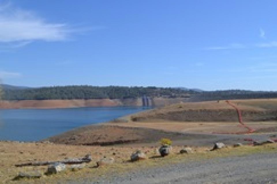
The continued wet weather in the Northstate has left quite an
impact at Shasta Lake. California’s largest reservoir rose a
foot from Thursday to Friday, and 5 feet from January 26 to
February 2. Currently, Shasta Lake sits at 1,035 feet, roughly
30 feet from capacity. That’s an increase of 47 feet from this
date last year. … Overall, the weather station at Shasta
Dam has reported 36.56 inches of rain since the water year
began on October 1.
Though the Delta Conveyance Project was only recently
approved by the Department of Water Resources after completing
the lengthy California Environmental Quality Act (CEQA)
process, the project faces new obstacles to implementation.
Nine lawsuits challenging DWR’s December 21, 2023 approval of
the Project were recently filed in Sacramento County Superior
Court by a total of thirty-three plaintiffs representing all
the Delta counties, the City of Stockton, environmental and
other nongovernmental organizations, and tribe[s]. Resolution
of that litigation could take several years.
As the permitting battle over the proposed Sites Reservoir
Project in Northern California heats up, it’s become clear that
the project would further heat up the atmosphere as well. Just
as California has made bold commitments to achieve carbon
neutrality in the next few decades, the state seems ready to
approve a dam project that would put that progress in jeopardy.
A new report, “Estimate of Greenhouse Gas Emissions for the
Proposed Sites Reservoir Project Using the All-Res Modeling
Tool,” created by a science team at my organization, Tell The
Dam Truth, exposes the climate impacts caused by this massive
dam and reservoir system. -Written by Gary Wockner, PhD, who directs Tell The
Dam Truth
Growing up in the shadow of the
Rocky Mountains, Andrew Schwartz never missed an opportunity to
play in – or study – a Colorado snowstorm. During major
blizzards, he would traipse out into the icy wind and heavy
drifts of snow pretending to be a scientist researching in
Antarctica.
Decades later, still armed with an obsession for extreme weather,
Schwartz has landed in one of the snowiest places in the West,
leading a research lab whose mission is to give California water
managers instant information on the depth and quality of snow
draping the slopes of the Sierra Nevada.
This tour explored the Sacramento River and its tributaries through a scenic landscape while learning about the issues associated with a key source for the state’s water supply.
All together, the river and its tributaries supply 35 percent of California’s water and feed into two major projects: the State Water Project and the federal Central Valley Project.
Water Education Foundation
2151 River Plaza Drive, Suite 205
Sacramento, CA 95833
This tour explored the Sacramento River and its tributaries
through a scenic landscape while learning about the issues
associated with a key source for the state’s water supply.
All together, the river and its tributaries supply 35 percent of
California’s water and feed into two major projects: the State
Water Project and the federal Central Valley Project.
Water Education Foundation
2151 River Plaza Drive, Suite 205
Sacramento, CA 95833
In the vast labyrinth of the West
Coast’s largest freshwater tidal estuary, one native fish species
has never been so rare. Once uncountably numerous, the Delta
smelt was placed on state and federal endangered species lists in
1993, stopped appearing in most annual sampling surveys in 2016,
and is now, for all practical purposes, extinct in the wild. At
least, it was.
Land and waterway managers labored
hard over the course of a century to control California’s unruly
rivers by building dams and levees to slow and contain their
water. Now, farmers, environmentalists and agencies are undoing
some of that work as part of an accelerating campaign to restore
the state’s major floodplains.
This tour guided participants on a virtual exploration of the Sacramento River and its tributaries and learn about the issues associated with a key source for the state’s water supply.
All together, the river and its tributaries supply 35 percent of California’s water and feed into two major projects: the State Water Project and the federal Central Valley Project.
This tour guided participants on a virtual journey deep into California’s most crucial water and ecological resource – the Sacramento-San Joaquin Delta. The 720,000-acre network of islands and canals support the state’s two major water systems – the State Water Project and the Central Valley Project. The Delta and the connecting San Francisco Bay form the largest freshwater tidal estuary of its kind on the West coast.
USACE Sacramento District has a proven track record of facing
challenges head-on. When 2020 brought with it the Novel
Coronavirus, the District responded quickly to address the
needs of a rapidly changing work environment…This year marked
the start of major construction on the [American River Common
Features] project, and the pandemic hit just as crews were
mobilizing, meaning both USACE and its contractors faced
unexpected public impacts.
Voluntary agreements in California
have been touted as an innovative and flexible way to improve
environmental conditions in the Sacramento-San Joaquin Delta
and the rivers that feed it. The goal is to provide river flows
and habitat for fish while still allowing enough water to be
diverted for farms and cities in a way that satisfies state
regulators.
California is chock full of rivers and creeks, yet the state’s network of stream gauges has significant gaps that limit real-time tracking of how much water is flowing downstream, information that is vital for flood protection, forecasting water supplies and knowing what the future might bring.
That network of stream gauges got a big boost Sept. 30 with the signing of SB 19. Authored by Sen. Bill Dodd (D-Napa), the law requires the state to develop a stream gauge deployment plan, focusing on reactivating existing gauges that have been offline for lack of funding and other reasons. Nearly half of California’s stream gauges are dormant.
The deadliest and most destructive
wildfire in California history had a severe impact on the water
system in the town of Paradise. Participants on our Oct. 2-4
Northern California
Tour will hear from Kevin Phillips, general manager of
Paradise Irrigation District, on the scope of the damages, the
obstacles to recovery and the future of the water district.
The Camp Fire destroyed 90 percent of the structures in Paradise,
and 90 percent of the irrigation district’s ratepayer base. The
fire did not destroy the irrigation district’s water storage or
treatment facilities, but it did melt plastic pipes, releasing
contaminants into parts of the system and prompting do-not-drink
advisories to water customers.
Get an up-close look at some of
California’s key water reservoirs and learn about farming
operations, salmon habitat restoration, flood management and
wetlands on our Northern California Water Tour Oct. 2-4.
Each year, participants on the tour enjoy three days exploring
the Sacramento Valley during the temperate fall. Join us as we
travel through a scenic landscape along the Sacramento and
Feather rivers to learn about issues associated with storing
and delivering the state’s water supply.
One of California Gov. Gavin
Newsom’s first actions after taking office was to appoint Wade
Crowfoot as Natural Resources Agency secretary. Then, within
weeks, the governor laid out an ambitious water agenda that
Crowfoot, 45, is now charged with executing.
That agenda includes the governor’s desire for a “fresh approach”
on water, scaling back the conveyance plan in the Sacramento-San
Joaquin Delta and calling for more water recycling, expanded
floodplains in the Central Valley and more groundwater recharge.
Bruce Babbitt, the former Arizona
governor and secretary of the Interior, has been a thoughtful,
provocative and sometimes forceful voice in some of the most
high-profile water conflicts over the last 40 years, including
groundwater management in Arizona and the reduction of
California’s take of the Colorado River. In 2016, former
California Gov. Jerry Brown named Babbitt as a special adviser to
work on matters relating to the Sacramento-San Joaquin Delta and
the Delta tunnels plan.
The growing leadership of women in water. The Colorado River’s persistent drought and efforts to sign off on a plan to avert worse shortfalls of water from the river. And in California’s Central Valley, promising solutions to vexing water resource challenges.
These were among the topics that Western Water news explored in 2018.
We’re already planning a full slate of stories for 2019. You can sign up here to be alerted when new stories are published. In the meantime, take a look at what we dove into in 2018:
This tour explored the Sacramento River and its tributaries
through a scenic landscape as participants learned about the
issues associated with a key source for the state’s water supply.
All together, the river and its tributaries supply 35 percent of
California’s water and feed into two major projects: the State
Water Project and the federal Central Valley Project. Tour
participants got an on-site update of Oroville Dam spillway
repairs.
The Colorado River Basin is more
than likely headed to unprecedented shortage in 2020 that could
force supply cuts to some states, but work is “furiously”
underway to reduce the risk and avert a crisis, Bureau of
Reclamation Commissioner Brenda Burman told an audience of
California water industry people.
During a keynote address at the Water Education Foundation’s
Sept. 20 Water Summit in Sacramento, Burman said there is
opportunity for Colorado River Basin states to control their
destiny, but acknowledged that in water, there are no guarantees
that agreement can be reached.
An hour’s drive north of Sacramento sits a picture-perfect valley hugging the eastern foothills of Northern California’s Coast Range, with golden hills framing grasslands mostly used for cattle grazing.
Back in the late 1800s, pioneer John Sites built his ranch there and a small township, now gone, bore his name. Today, the community of a handful of families and ranchers still maintains a proud heritage.
Farmers in the Central Valley are broiling about California’s plan to increase flows in the Sacramento and San Joaquin river systems to help struggling salmon runs avoid extinction. But in one corner of the fertile breadbasket, River Garden Farms is taking part in some extraordinary efforts to provide the embattled fish with refuge from predators and enough food to eat.
And while there is no direct benefit to one farm’s voluntary actions, the belief is what’s good for the fish is good for the farmers.
The Sacramento and San Joaquin
rivers are the two major Central Valley waterways that feed the
Delta, the hub of California’s water supply
network. Our last water tours of
2018 will look in-depth at how these rivers are managed and
used for agriculture, cities and the environment. You’ll see
infrastructure, learn about efforts to restore salmon runs and
talk to people with expertise on these rivers.
Get an up-close look at some of
California’s key water reservoirs and learn about farming
operations, habitat restoration, flood management and wetlands in
the Sacramento Valley on our Northern California Water Tour
Oct. 10-12.
Each year, participants on the Northern California Water Tour
enjoy three days exploring the Sacramento Valley during the
temperate fall. Join us as we travel through a scenic landscape
along the Sacramento and Feather rivers to learn about
issues associated with storing and delivering the state’s water
supply.
New water storage is the holy grail
primarily for agricultural interests in California, and in 2014
the door to achieving long-held ambitions opened with the passage
of Proposition
1, which included $2.7 billion for the public benefits
portion of new reservoirs and groundwater storage projects. The
statute stipulated that the money is specifically for the
benefits that a new storage project would offer to the ecosystem,
water quality, flood control, emergency response and recreation.
For more than 100 years, invasive
species have made the Sacramento-San Joaquin Delta their home,
disrupting the ecosystem and costing millions of dollars annually
in remediation.
The latest invader is the nutria, a large rodent native to South
America that causes concern because of its propensity to devour
every bit of vegetation in sight and destabilize levees by
burrowing into them. Wildlife officials are trapping the animal
and trying to learn the extent of its infestation.
Along the banks of the
Sacramento-San Joaquin Delta in Oakley, about 50 miles southwest
of Sacramento, is a park that harkens back to the days when the
Delta lured Native Americans, Spanish explorers, French fur
trappers, and later farmers to its abundant wildlife and rich
soil.
That historical Delta was an enormous marsh linked to the two
freshwater rivers entering from the north and south, and tidal
flows coming from the San Francisco Bay. After the Gold Rush,
settlers began building levees and farms, changing the landscape
and altering the habitat.
Despite the heat that often
accompanies debates over setting aside water for the environment,
there are instances where California stakeholders have forged
agreements to provide guaranteed water for fish. Here are two
examples cited by the Public Policy Institute of California in
its report arguing for an environmental water right.
Does California need to revamp the way in which water is dedicated to the environment to better protect fish and the ecosystem at large? In the hypersensitive world of California water, where differences over who gets what can result in epic legislative and legal battles, the idea sparks a combination of fear, uncertainty and promise.
Saying that the way California manages water for the environment “isn’t working for anyone,” the Public Policy Institute of California (PPIC) shook things up late last year by proposing a redesigned regulatory system featuring what they described as water ecosystem plans and water budgets with allocations set aside for the environment.
This tour explored the Sacramento River and its tributaries
through a scenic landscape as participants learned about the
issues associated with a key source for the state’s water supply.
All together, the river and its tributaries supply 35 percent of
California’s water and feed into two major projects: the State
Water Project and the federal Central Valley Project. Tour
participants got an on-site update of repair efforts on the
Oroville Dam spillway.
The Sacramento and San Joaquin are the two major rivers in the
Central Valley that feed the Delta, the hub of
California’s water supply network.
Our last two water tours of 2017 will take in-depth looks at how
these rivers are managed and used for agriculture, cities and the
environment. You’ll see infrastructure, learn about efforts to
restore salmon runs and talk to people with expertise on these
rivers.
Each year, participants on the Northern California Water Tour
enjoy three days exploring the Sacramento Valley during the
temperate fall. Join us as we travel along the Sacramento and
Feather rivers through a scenic landscape and learn about
issues associated with storing and delivering the state’s water
supply.
Before dams were built on the upper
Sacramento River, flood water regularly carried woody debris that
was an important part of the aquatic habitat.
Deprived of this refuge, salmon in the lower parts of the upper
Sacramento River have had a difficult time surviving and making
it down the river and out to the ocean. Seeing this, a group of
people, including water users, decided to lend a hand with an
unprecedented pilot project that saw massive walnut tree trunks
affixed to 12,000-pound boulders and deposited into the deepest
part of the Sacramento River near Redding to provide shelter for
young salmon and steelhead migrating downstream.
Protecting and restoring California’s populations of threatened
and endangered Chinook salmon and steelhead trout have been a big
part of the state’s water management picture for more than 20
years. Significant resources have been dedicated to helping the
various runs of the iconic fish, with successes and setbacks. In
a landscape dramatically altered from its natural setting,
finding a balance between the competing demands for water is
challenging.
Butte Creek, a tributary of the
Sacramento River, begins less than 50 miles northeast of Chico,
California and is named after nearby volcanic plateaus or
“buttes.” The cold, clear waters of the 93-mile creek sustain the
largest naturally spawning wild population of spring-run chinook salmon in the Central Valley.
Several other native fish species are found in Butte Creek,
including Pacific lamprey and Sacramento pikeminnow.
Whiskeytown Lake, a major reservoir in the foothills of the
Klamath Mountains nine miles west of Redding, was
built at the site of one of Shasta County’s first Gold Rush
communities. Whiskeytown, originally called
Whiskey Creek Diggings, was founded in 1849 and named in
reference to a whiskey barrel rolling off a citizen’s pack mule;
it may also refer to miners drinking a barrel per day.
Headwaters are the source of a
stream or river. They are located at the furthest point from
where the water body empties or merges with
another. Two-thirds of California’s surface water supply
originates in these mountainous and typically forested regions.
The American River, with headwaters
in the Tahoe and Eldorado national forests of the Sierra Nevada,
is the birthplace of the California Gold Rush. It currently
serves as a major water supply, recreational destination and
habitat for hundreds of species. The geologically diverse
North, Middle and South forks comprise the American
River or the Río de los Americanos, as it was called during
California’s Mexican rule.
The proposed Sites Reservoir would be an off-river storage basin
on the west side of the Sacramento Valley, about 78 miles
northwest of Sacramento. It would capture stormwater flows from
the Sacramento River for release in dry and critical years for
fish and wildlife and for farms, communities and businesses.
The water would be held in a 14,000-acre basin of grasslands
surrounded by the rolling eastern foothills of the Coast Range.
Known as Antelope Valley, the sparsely populated area in Glenn
and Colusa counties is used for livestock grazing.
This 30-minute documentary-style DVD on the history and current
state of the San Joaquin River Restoration Program includes an
overview of the geography and history of the river, historical
and current water delivery and uses, the genesis and timeline of
the 1988 lawsuit, how the settlement was reached and what was
agreed to.
This 25-minute documentary-style DVD, developed in partnership
with the California Department of Water Resources, provides an
excellent overview of climate change and how it is already
affecting California. The DVD also explains what scientists
anticipate in the future related to sea level rise and
precipitation/runoff changes and explores the efforts that are
underway to plan and adapt to climate.
30-minute DVD that traces the history of the U.S. Bureau of
Reclamation and its role in the development of the West. Includes
extensive historic footage of farming and the construction of
dams and other water projects, and discusses historic and modern
day issues.
The 24-page Layperson’s Guide to the State Water Project provides
an overview of the California-funded and constructed State Water
Project.
The State Water Project is best known for the 444-mile-long
aqueduct that provides water from the Delta to San Joaquin Valley
agriculture and southern California cities. The guide contains
information about the project’s history and facilities.
The 24-page Layperson’s Guide to Flood Management explains the
physical flood control system, including levees; discusses
previous flood events (including the 1997 flooding); explores
issues of floodplain management and development; provides an
overview of flood forecasting; and outlines ongoing flood control
projects.
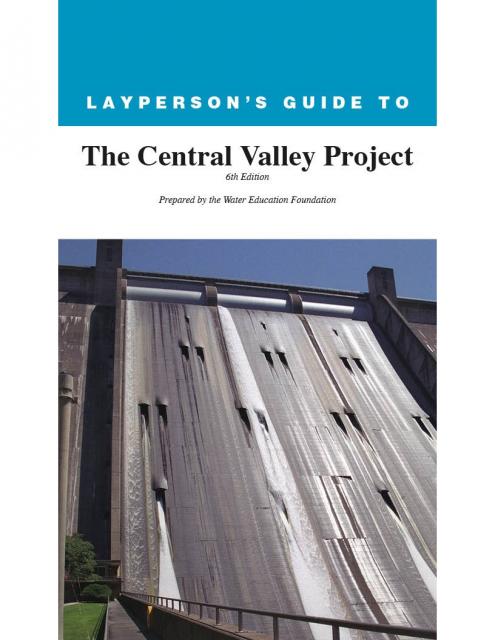
The 24-page Layperson’s Guide to the Central Valley Project
explores the history and development of the federal Central
Valley Project (CVP), California’s largest surface water delivery
system. In addition to the project’s history, the guide describes
the various CVP facilities, CVP operations, the benefits the CVP
brought to the state and the CVP Improvement Act (CVPIA).
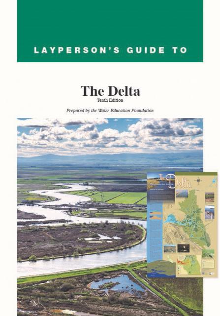
The 24-page Layperson’s Guide to the Delta explores the competing
uses and demands on California’s Sacramento-San Joaquin Delta.
Included in the guide are sections on the history of the Delta,
its role in the state’s water system, and its many complex issues
with sections on water quality, levees, salinity and agricultural
drainage, fish and wildlife, and water distribution.
A new look for our most popular product! And it’s the perfect
gift for the water wonk in your life.
Our 24×36 inch California Water Map is widely known for being the
definitive poster that shows the integral role water plays in the
state. On this updated version, it is easier to see California’s
natural waterways and man-made reservoirs and aqueducts
– including federally, state and locally funded
projects – the wild and scenic rivers system, and
natural lakes. The map features beautiful photos of
California’s natural environment, rivers, water projects,
wildlife, and urban and agricultural uses and the
text focuses on key issues: water supply, water use, water
projects, the Delta, wild and scenic rivers and the Colorado
River.
A watershed is the land area that drains snowmelt and rain into a
network of lakes, streams, rivers and other waterways. It
typically is identified by the largest draining watercourse
within the system. In California, for example, the Sacramento River Basin is the
state’s largest watershed.
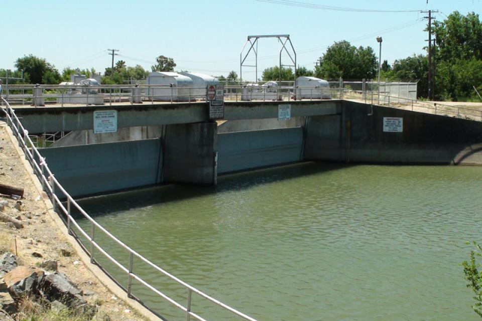
The 6,000-foot Delta Cross Channel diverts water from the
Sacramento River into a
branch of the Mokelumne River, where it follows natural channels
for about 50 miles to the Jones Pumping Plant
intake channel. Located near the State Water Project’s
Harvey O.
California’s largest river, the Sacramento, provides
31 percent of the state’s surface water runoff.
Once called “the Nile of the West,” the Sacramento River drains
the inland slopes of the Klamath Mountains, the Cascade Range,
the Coast Ranges and the western slopes of the northern Sierra Nevada. The river stretches
some 384 miles from its headwaters near Mount Shasta to the
Sacramento-San
Joaquin Delta.
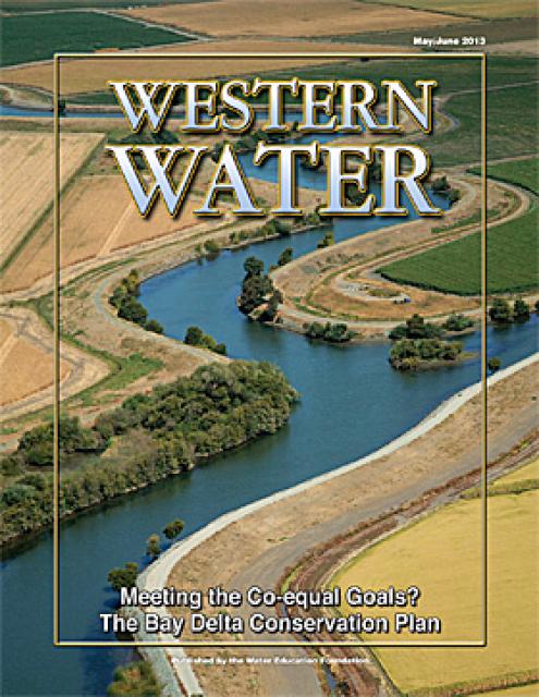
This issue of Western Water looks at the BDCP and the
Coalition to Support Delta Projects, issues that are aimed at
improving the health and safety of the Delta while solidifying
California’s long-term water supply reliability.
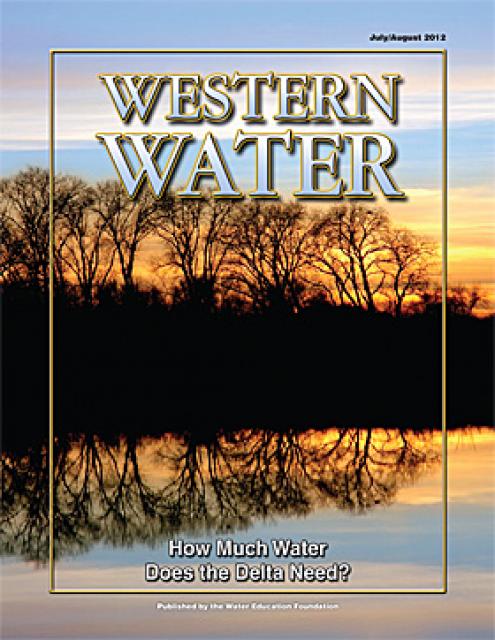
This printed issue of Western Water examines the issues
associated with the State Water Board’s proposed revision of the
water quality Bay-Delta Plan, most notably the question of
whether additional flows are needed for the system, and how they
might be provided.
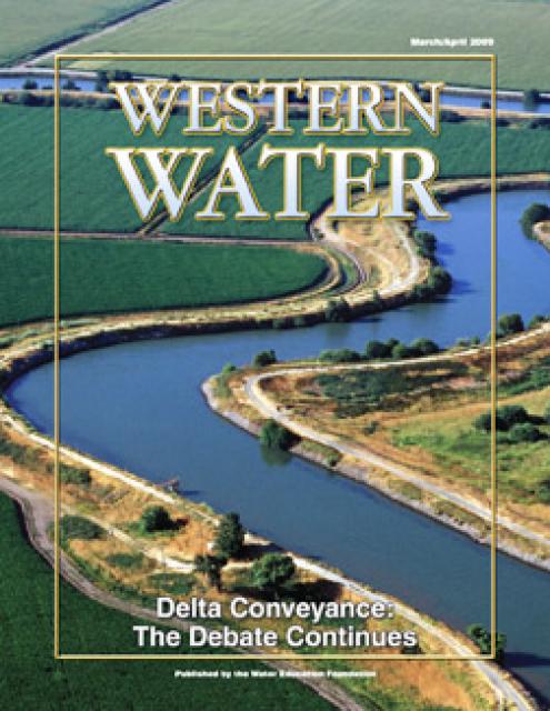
This printed issue of Western Water provides an overview of the
idea of a dual conveyance facility, including questions
surrounding its cost, operation and governance
This printed copy of Western Water examines the native salmon and
trout dilemma – the extent of the crisis, its potential impact on
water deliveries and the lengths to which combined efforts can
help restore threatened and endangered species.
This printed copy of Western Water examines the Delta through the
many ongoing activities focusing on it, most notably the Delta
Vision process. Many hours of testimony, research, legal
proceedings, public hearings and discussion have occurred and
will continue as the state seeks the ultimate solution to the
problems tied to the Delta.
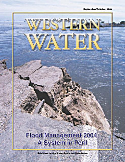
This issue of Western Water analyzes northern California’s
extensive flood control system – it’ history, current concerns,
the Paterno decision and how experts are re-thinking the concept
of flood management.
This issue of Western Water examines the presence of mercury in
the environment and the challenge of limiting the threat posed to
human health and wildlife. In addition to outlining the extent of
the problem and its resistance to conventional pollution
remedies, the article presents a glimpse of some possible courses
of action for what promises to be a long-term problem.


")


")
")

")
 and temperature. This gauge near downtown Sacramento measures water depth. (Source: California Department of Water Resources)")

")
")
: Karla Nemeth, director, California Department of Water Resources; Gloria Gray, chair, Metropolitan Water District of Southern California; Brenda Burman, Bureau of Reclamation Commissioner; Jayne Harkins, commissioner, International Boundary and Water Commission, U.S. and Mexico; Amy Haas, executive director, Upper Colorado River Commission.")

")
")
")
")
")
")