World renowned for its crystal clear, azure water, Lake Tahoe
straddles the Nevada-California border. However, the lake’s
clarity has declined in the last 40 years due to accumulated
effects of development.
At 1,645 feet, Lake Tahoe is the second deepest lake in the
United States and the 10th deepest in the world. Lake Tahoe sits
6,225 feet above sea level, and is 22 miles long and 12 miles
wide.
Approximately 40 percent of the Tahoe Basin’s rain and snow fall
directly into the lake, contributing to Lake Tahoe’s legendary
clarity. The remaining precipitation drains through granitic
soils, which are relatively sterile and create a good filtering
system.
The lake’s vitality is threatened by several factors
including invasive species (trout and bass), stormwater
runoff and increasing temperatures as a part of ongoing climate
change. Meanwhile, drought conditions have led the lake to be the
driest it has been in a century.
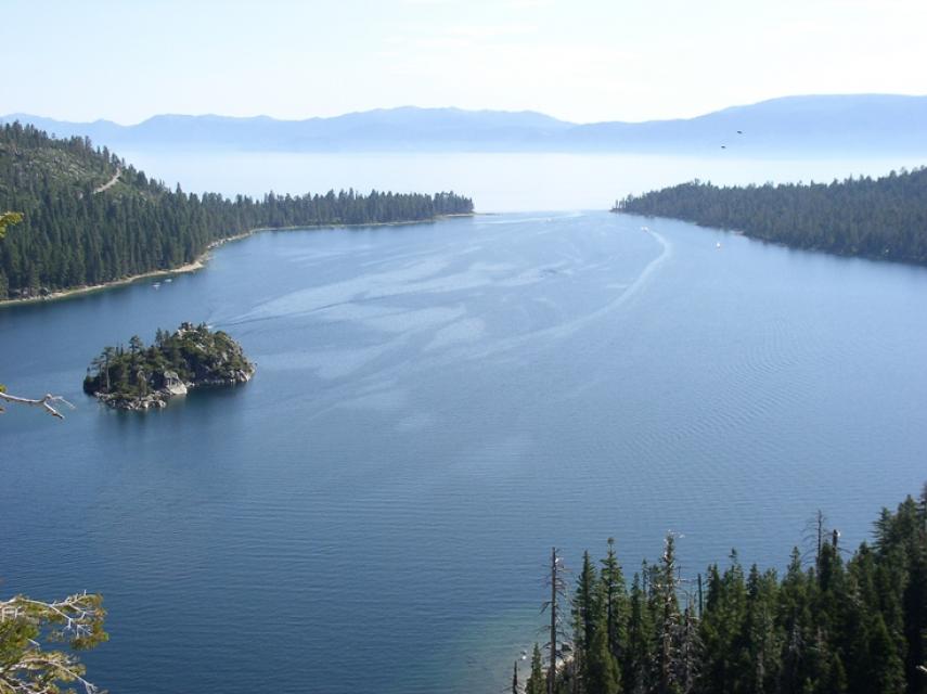
Emerald Bay is known for its beauty, with an island castle at
its center, and an underwater state park full of sunken boats.
But that’s not all that lies beneath the water’s surface. Two
defunct, lead-clad telecommunications cables run across the
mouth of the bay and along Tahoe’s southwestern shores. An
ongoing court battle and investigation by the Wall Street
Journal have brought the cables into the public eye. The
California Sportfishing Protection Alliance has sued AT&T
to have the cables removed, while competing studies by AT&T
and WSJ resulted in drastically different findings on whether
the lines pose any risk to the lake and its visitors.
El Dorado County is requesting public input while it develops
the Tahoe El Dorado (TED) Area Plan. The TED Area Plan is a
long-term planning document that will update and incorporate
the Meyers Area Plan and other communities in the Tahoe Basin
area of the County. The density, look, and character of a
community are defined by a variety of land use planning
documents. In the Tahoe Basin, land use falls under the El
Dorado County Zoning Ordinance and the Tahoe Regional Planning
Agency’s Regional Plan. Currently, the land use policies and
zoning designations in some areas conflict with each other.
This creates confusion about what is allowed and what can be
built on these properties. Conflicting land use policies
constrain new projects on those sites.
Spring is a time of rebirth and renewal. And this season, Tahoe
is witnessing its own rebirth in the form of a species of bird
that had been previously driven out of the region. Sandhill
cranes are making an unexpected return to the Lake Tahoe basin
after a century long hiatus caused by overhunting. The birds
stand at about 4 feet tall with a wingspan of 7 feet and boast
a signature red patch on their head. The sandhill cranes are
often compared to dinosaurs by those lucky enough to witness
them due to their large size and loud croaks.
The Upper Truckee River Watershed is the largest contributor of
freshwater to Lake Tahoe. … With fewer floodplains, more fine
sediment and nutrients began flowing in, and the lake’s clarity
declined from more than 130 feet in the 1960s to a low point of
60 feet in 2017. … Once a healthy wetland, the property
is paved with asphalt, housing a defunct Motel 6 and a
long-shuttered restaurant. During the next several years,
the buildings will be razed, the asphalt removed and the
wetland restored, connecting 560 acres of the Upper Truckee
Marsh on the shores of Lake Tahoe to 206-acre Johnson Meadow
across Highway 50 to the south. It’s all part of a bigger
effort to restore the lake’s clarity by reclaiming habitat
around the 9 miles of the river closest to Lake Tahoe, an area
that has seen heavy development.
The USDA Forest Service Lake Tahoe Basin Management Unit
(LTBMU) released the final environmental review documents and
draft decision for the Meeks Bay Restoration Project. The
LTBMU, in conjunction with Tahoe Regional Planning Agency, and
Lahontan Regional Water Quality Control Board, is developing a
plan to restore Meeks Creek to a more natural condition, while
continuing to support sustainable recreation
opportunities. In 1960, a marina with approximately
120 boat slips and a boat launch facility was dredged at the
mouth of Meeks Creek, on the West Shore of Lake Tahoe. The
marina eliminated a unique wetland habitat for numerous bird,
mammal, and amphibian species.
For centuries, there was a familiar spring and summer element
in the Sierra Nevada skies: hundreds of enormous white
birds soaring over the lakes and mountains. On land, their
courtship displays were notable from afar as they leaped,
twirled and flapped their elegant black-tipped wings in
complicated shows to find a lifelong mate. With a wingspan of
around 7 feet and an average height of 5 feet, sandhill cranes
were once easy to spot around Lake Tahoe, even from a
distance. Due to overhunting and habitat loss, there were
only three or four breeding pairs throughout the entire state
by 1944, despite once likely numbering in the hundreds of
thousands. However, the state of California didn’t grant the
birds “fully protected” status until 1970.
For most Northern Nevadans and Californians, Lake Tahoe is more
than a distinctive spot on the map. Whether you only go a few
times a year or every single weekend, it always feels like your
refuge. You never take it for granted. Neither do the
scientists, planners, biologists, volunteers, lawmakers and
engineers who work to protect the lake from environmental
threats. In fact, the call to protect Lake Tahoe has echoed
across America in support of one of the most comprehensive and
successful conservation programs in the nation. Since public
and private partners established the Lake Tahoe Environmental
Improvement Program in 1997, we have completed more than 800
major restoration projects to protect one of our country’s most
treasured landscapes. -Written by Julie Regan, executive director of the
Tahoe Regional Planning Agency.
Tahoe community organizations ranging from business
associations to nonprofits to kayak rental companies have long
been begging the lake’s visitors to be more responsible with
picking up their trash. And now, the results of a two-year
study and monitoring project in Lake Tahoe could
suggest that the messaging may just be working. The
findings come from Clean Up The Lake’s two-year
project that sent scuba divers to clean up trash in 30 “litter
hot spots” between 0 and 25 feet deep along Lake
Tahoe’s shoreline. Hot spots were areas of
heavier-than-normal trash, identified via diver observations
and garbage data. The first sweep was finished in July
2021, and the second was completed in fall 2023. The study
found a significant decrease in litter over the two-year period
on the Nevada side of the lake
(the California areas have not yet been analyzed).
Two Tahoe towns are saying no to plastic water
bottles. South Lake Tahoe’s ban on single-use
plastic water bottles and paper cartons is slated to go into
full effect next month, soon after neighboring Truckee
passed an ordinance to implement a similar
ban. … The League to Save Lake Tahoe found that
single-use plastic bottles are one of the top five types of
litter in the Tahoe Basin, Truckee’s news release
states.
On average, more than 60 percent of
California’s developed water supply originates in the Sierra
Nevada and the southern spur of the Cascade Range. Our water
supply is largely dependent on the health of our Sierra forests,
which are suffering from ecosystem degradation, drought,
wildfires and widespread tree mortality.
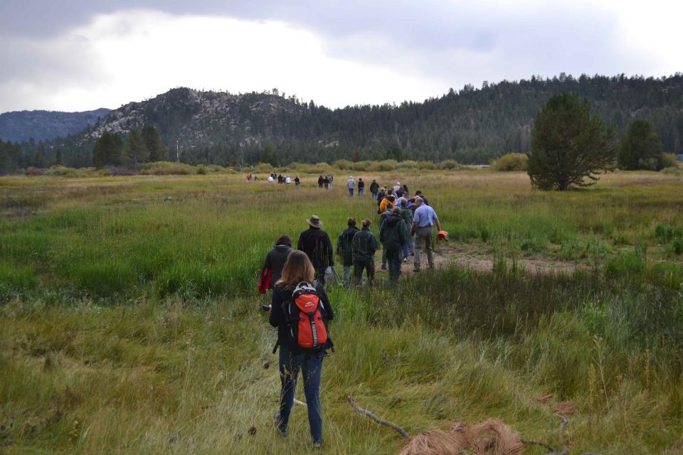
This tour ventured into the Sierra to examine water issues
that happen upstream but have dramatic impacts downstream and
throughout the state.
Sixty percent of California’s developed water supply
originates high in the Sierra Nevada mountains. Our water
supply is largely dependent on the health of our Sierra forests,
which are suffering from ecosystem degradation, drought,
wildfires and widespread tree mortality.
We headed into the foothills and the mountains to examine
water issues that happen upstream but have dramatic impacts
downstream and throughout the state.
GEI (Tour Starting Point)
2868 Prospect Park Dr.
Rancho Cordova, CA 95670.
Lake
Tahoe, the iconic high Sierra water body that straddles
California and Nevada, has sat for more than 10,000 years at the
heart of the Washoe tribe’s territory. In fact, the name Tahoe
came from the tribal word dá’aw, meaning lake.
The lake’s English name was the source of debate for about 100
years after it was first “discovered” in 1844 by people of
European descent when Gen. John C. Fremont’s expedition made its
way into the region. Not long after, a man who carried mail on
snowshoes from Placerville to Nevada City named it Lake Bigler in
honor of John Bigler, who served as California’s third governor.
But because Bigler was an ardent secessionist, the federal
Interior Department during the Civil War introduced the name
Tahoe in 1862. Meanwhile, California kept it as Lake Bigler and
didn’t officially recognize the name as Lake Tahoe until 1945.
Sixty percent of California’s developed water supply
originates high in the Sierra Nevada mountains. Our water
supply is largely dependent on the health of our Sierra forests,
which are suffering from ecosystem degradation, drought,
wildfires and widespread tree mortality.
This 25-minute documentary-style DVD, developed in partnership
with the California Department of Water Resources, provides an
excellent overview of climate change and how it is already
affecting California. The DVD also explains what scientists
anticipate in the future related to sea level rise and
precipitation/runoff changes and explores the efforts that are
underway to plan and adapt to climate.
30-minute DVD that traces the history of the U.S. Bureau of
Reclamation and its role in the development of the West. Includes
extensive historic footage of farming and the construction of
dams and other water projects, and discusses historic and modern
day issues.
This beautiful 24×36 inch poster, suitable for framing, displays
the rivers, lakes and reservoirs, irrigated farmland, urban areas
and Indian reservations within the Truckee River Basin, including
the Newlands Project, Pyramid Lake and Lake Tahoe. Map text
explains the issues surrounding the use of the Truckee-Carson
rivers, Lake Tahoe water quality improvement efforts, fishery
restoration and the effort to reach compromise solutions to many
of these issues.
This 24×36 inch poster, suitable for framing, illustrates the
water resources available for Nevada cities, agriculture and the
environment. It features natural and manmade water resources
throughout the state, including the Truckee and Carson rivers,
Lake Tahoe, Pyramid Lake and the course of the Colorado River
that forms the state’s eastern boundary.
The 28-page Layperson’s Guide to Nevada Water provides an
overview of the history of water development and use in Nevada.
It includes sections on Nevada’s water rights laws, the history
of the Truckee and Carson rivers, water supplies for the Las
Vegas area, groundwater, water quality, environmental issues and
today’s water supply challenges.
A new look for our most popular product! And it’s the perfect
gift for the water wonk in your life.
Our 24×36 inch California Water Map is widely known for being the
definitive poster that shows the integral role water plays in the
state. On this updated version, it is easier to see California’s
natural waterways and man-made reservoirs and aqueducts
– including federally, state and locally funded
projects – the wild and scenic rivers system, and
natural lakes. The map features beautiful photos of
California’s natural environment, rivers, water projects,
wildlife, and urban and agricultural uses and the
text focuses on key issues: water supply, water use, water
projects, the Delta, wild and scenic rivers and the Colorado
River.
Lake Tahoe is one of the world’s most beautiful yet vulnerable
lakes. Renowned for its remarkable clarity, Tahoe straddles the
Nevada-California border, stretching 22 miles long and 12 miles
wide in a granitic bowl high in the Sierra Nevada.
Tahoe sits 6,225 feet above sea level. Its deepest point is 1,645
feet, making it the second-deepest lake in the nation, after
Oregon’s Crater Lake, and the tenth deepest in the world.
Lake Tahoe is one of the Sierra Nevada’s crown jewels, renowned
for its breathtaking clarity. The high-altitude, clear blue lake
and its surrounding basin, which lie on the California-Nevada
state line, is a spectacular natural resource that provides
environmental, economic, recreational and aesthetic benefits.


")