An ecosystem includes all of the living organisms (plants,
animals and microbes) in a given area, interacting with each
other, and also with their non-living environments (air, water
and soil).
Ecosystems are dynamic and are impacted by disturbances such as a
drought, an extraordinarily freezing winter, and pests.
Longer-term disturbances include climate change effects.
Ecosystems provide a variety of goods and services upon which
people depend. Ecosystem management emphasizes managing natural
resources at the level of the ecosystem itself and not just
managing individual species.
The California Legislature was the first in the country to
protect rare plants and animals through passage of the California
Endangered Species Act in 1970. Congress followed suit in 1973 by
passing the federal Endangered Species Act.
El Dorado County is requesting public input while it develops
the Tahoe El Dorado (TED) Area Plan. The TED Area Plan is a
long-term planning document that will update and incorporate
the Meyers Area Plan and other communities in the Tahoe Basin
area of the County. The density, look, and character of a
community are defined by a variety of land use planning
documents. In the Tahoe Basin, land use falls under the El
Dorado County Zoning Ordinance and the Tahoe Regional Planning
Agency’s Regional Plan. Currently, the land use policies and
zoning designations in some areas conflict with each other.
This creates confusion about what is allowed and what can be
built on these properties. Conflicting land use policies
constrain new projects on those sites.
If you’re like us, you’re inspired by the natural world and
eager to see California’s beautiful mountains, forests, and
lakes protected for future generations. You also might be
surprised to hear that the health and survival of these places
depends on one species more than most: beavers. Put simply,
beavers are our partners in protecting and restoring
California. Beavers are known as a “keystone species,” meaning
they create, modify, and maintain critical ecosystems for
insects, birds, mammals, fish, plants, and trees. -Written by Kate Lundquist and Brock Dolman,
Co-Directors of the Watershed Advocacy, Training, Education, &
Research (WATER) Institute and the Bring Back the Beaver
Campaign at the Occidental Arts & Ecology Center.
Rebuilding beaches after hurricanes is costing U.S. taxpayers
billions of dollars more than expected as the Army Corps of
Engineers pumps mountains of sand onto storm-obliterated
shorelines. Congress approved more than $770 million since 2018
for emergency beach “nourishment” projects after five
megastorms struck Florida, Georgia and the Carolinas. Those
costs shattered government expectations about the price of
preventing beaches from disappearing through decades-old
programs that in many cases were created before the dangerous
effects of climate change were fully understood. Four of those
storms — Michael, Maria, Irma and Ian — were among the most
powerful to make landfall in the United States, raising
questions about the rising costs of pumping, dumping and
spreading sand onto beaches that are increasingly jeopardized
by the effects of climbing temperatures.
Spring is a time of rebirth and renewal. And this season, Tahoe
is witnessing its own rebirth in the form of a species of bird
that had been previously driven out of the region. Sandhill
cranes are making an unexpected return to the Lake Tahoe basin
after a century long hiatus caused by overhunting. The birds
stand at about 4 feet tall with a wingspan of 7 feet and boast
a signature red patch on their head. The sandhill cranes are
often compared to dinosaurs by those lucky enough to witness
them due to their large size and loud croaks.
The governance of San Francisco Bay/Sacramento-San Joaquin
Delta water quality falls under the authority of the State
Water Quality Control Board. Among other duties, the Water
Board is responsible for adopting and updating the Bay-Delta
Water Quality Control Plan for the San Francisco
Bay/Sacramento-San Joaquin Delta Estuary (Bay-Delta
Plan). The Bay-Delta Plan’s purpose sets forth measures
and flow requirements to safeguard various water uses within
the watershed, including municipal, industrial, agricultural,
and ecological needs. Comprising five political appointees with
extensive powers, the Water Board plays a pivotal role in
shaping California’s water management policies. -Written by Cary Keaten, the general manager of
the Solano Irrigation District.
A Supreme Court decision that stripped protections from
America’s wetlands will have reverberating impacts on rivers
that supply drinking water all over the U.S., according to a
new report. The rivers of New Mexico are among the waterways
that will be affected most by the May 2023 Supreme Court
decision in Sackett v. EPA, which rolled back decades of
federal safeguards under the Clean Water Act for about half of
the nation’s wetlands and up to four million miles of streams
that supply drinking water for up to four million people,
according to the report, titled “America’s Most Endangered
Rivers of 2024.” … [The report, issued by the advocacy group
American Rivers, also cited the Trinity River in
California and the Tijuana River in California and Mexico as
among the ten most endangered rivers.]
Each morning is similar, but different. As we approach the pond
on the wooden catwalk, you can hear the birds calling,
eventually you start to smell the freshness of the ecosystem,
the glitters and splashing ahead gives some indication of bird
activity on the water. Sometimes an alligator lizard scoots
past along the floorwork – occasionally even two. Steam rises
from my coffee cup, to varying degrees, depending on how
quickly we got out the door. And then there are my three kids,
also ever changing. Each day, one to three are in-tow, usually
chatting it up about geology, Egypt, space, or the day’s most
pressing sports news. And so it goes on most mornings, ideally
when the mist is still fresh or the winter fog lingering, the
Rypel family ventures to the “the duck pond” aka Julie
Partansky Pond in north Davis.
Near the western tip of the Mojave Desert and a few miles west
of NASA’s Armstrong Flight Research Center, fields of
wildflowers painted the landscape yellow in spring 2024. On
April 9, the OLI (Operational Land Imager) on the Landsat 8
satellite acquired this image of fields of yellow wildflowers
blanketing Antelope Valley amid solar and wind farms. The day
after the image was acquired, the Antelope Valley California
Poppy Reserve reported that wildflowers were “popping,” but the
region’s famous poppies were not. Rangers at the reserve said
they also saw very few small poppy plants maturing, suggesting
an impressive poppy bloom is unlikely in the coming weeks.
Four years ago, over 97% of Big Basin Redwoods State Park in
Santa Cruz County burned during the state’s worst wildfire
season in recorded history. Last year, unprecedented winter
storms caused an estimated $190 million in damages to coastal
parks. And at Seacliff State Beach, also in Santa Cruz County,
storms flooded the campground and destroyed the beach’s
historic pier. Climate change and the resulting severe
wildfires, extreme storms and rising sea levels are
increasingly threatening our beloved state parks. … To
address this unprecedented threat, we need to create
climate-resilient state parks that can prepare for, adapt to
and recover from climate impacts. -Written by Rachel Norton, the executive director
of the California State Parks Foundation.
The U.S. Environmental Protection Agency (EPA) today announced
a proposed settlement with Shasta-Siskiyou Transport of
Redding, Calif. to resolve claims of Clean Water Act (CWA)
violations after one of the company’s trucks overturned and a
fuel product spilled into storm drains in downtown Redding. The
fuel reached the Sacramento River. The proposed settlement
requires Shasta-Siskiyou Transport to pay a civil penalty of
$208,840. … On Jan. 21, 2022, one of Shasta-Siskiyou
Transport’s trucks was transporting transmix, a mixture of
gasoline, diesel fuel, and other petroleum distillates, when
the truck overturned in downtown Redding, releasing transmix
into nearby storm drains, which led directly to Calaboose Creek
and subsequently into the Sacramento River.
President Biden plans to expand the perimeters of two national
monuments in California, protecting mountains and meadows in a
remote area between Napa and Mendocino as well as a rugged
stretch east of Los Angeles, two people familiar with the
administration’s plans said Thursday. The San Gabriel Mountains
National Monument and the Berryessa Snow Mountain National
Monument will each get new boundaries designed to protect land
of cultural significance to Native American tribes, as well as
biodiversity and wildlife corridors, said the people, who asked
not to be named because they were not authorized to discuss the
plans publicly.
The Upper Truckee River Watershed is the largest contributor of
freshwater to Lake Tahoe. … With fewer floodplains, more fine
sediment and nutrients began flowing in, and the lake’s clarity
declined from more than 130 feet in the 1960s to a low point of
60 feet in 2017. … Once a healthy wetland, the property
is paved with asphalt, housing a defunct Motel 6 and a
long-shuttered restaurant. During the next several years,
the buildings will be razed, the asphalt removed and the
wetland restored, connecting 560 acres of the Upper Truckee
Marsh on the shores of Lake Tahoe to 206-acre Johnson Meadow
across Highway 50 to the south. It’s all part of a bigger
effort to restore the lake’s clarity by reclaiming habitat
around the 9 miles of the river closest to Lake Tahoe, an area
that has seen heavy development.
California fishermen spoke out against state water management
policies Thursday after federal fishing officials canceled
ocean salmon fishing season in the state for the second
consecutive year, delivering a major blow to the fishing
industry. … Salmon stocks have been impacted by the
state’s multi-year drought and climate disruptions, including
wildfires, algal blooms and ocean forage shifts, according to
the California Department of Fish and Wildlife. The salmon
population has also been impacted by rising river water
temperatures in addition to a rollback of federal
protections for waterways by the Trump administration.
As the burning of fossil fuels and other human activities
continue to increase the levels of carbon dioxide in the
atmosphere, the ocean is absorbing a large portion of the CO2,
which is making seawater more acidic. … And here’s one
important fact about ocean acidification: It’s not happening at
the same rate everywhere. The California coast is one of the
regions of the world where ocean acidification
is occurring the fastest. … In particular, effluent
discharged from coastal sewage treatment plants, which has high
nitrogen levels from human waste, has been shown to
significantly contribute to ocean acidification off the
Southern California coast.
In a devastating blow to California’s fishing industry, federal
fishery managers unanimously voted today to cancel all
commercial and recreational salmon fishing off the coast of
California for the second year in a row. The decision is
designed to protect California’s dwindling salmon populations
after drought and water diversions left river flows too warm
and sluggish for the state’s iconic Chinook salmon to
thrive. … Many in the fishing industry say they
support the closure, but urged state and federal officials to
do more to improve conditions in the rivers salmon rely on.
Fishing advocates and environmentalists have lambasted Gov.
Gavin Newsom’s administration for failing to prioritize
water quality and flows to protect salmon in the
vital Bay-Delta watershed.
The water in California’s San Francisco Bay could rise more
than two meters by the year 2100. For the region’s tidal
marshes and their inhabitants, such as the endangered Ridgway’s
rail and the salt marsh harvest mouse, it’s a potential death
sentence. Given enough time, space, and sediment, tidal marshes
can build layers of mud and decaying vegetation to keep up with
rising seas. Unfortunately, upstream dams and a long history of
dredging bays and dumping the sediment offshore are starving
many tidal marshes around the world of the sediment they need
to grow. To keep its marshes above water, San Francisco Bay
needs more than 545 million tonnes of dirt by 2100.
The Klamath River in southern Oregon and northern California is
now running freer. In late 2023 and early 2024, four of the six
dams along the river were breached and reservoirs drained.
These actions were part of an effort to restore hundreds of
miles of riparian habitat. It is thought to be the largest dam
removal project in history. The four dams—Iron Gate, Copco No.
1, Copco No. 2, and J.C. Boyle—were built between 1918 and 1962
to generate electricity. Facing steep costs to modernize them
in the early 2000s, the utility that owned the dams opted for
deconstruction instead. In addition to removing aging
infrastructure, the project is expected to eliminate the
ecosystem and human health risks posed by toxic algae, which
has regularly reached harmful levels in the reservoirs since
2005.
Over the past few decades, the United States has imported most
of its lithium from Chile and Argentina, but there’s one major
domestic source of the mineral—Nevada. Clayton Valley, a remote
basin in the nation’s driest state, is home to the Silver Peak
mine, where lithium is extracted in gridded ponds that turn
neon blue as they recover one of Earth’s lightest elements
through solar evaporation. … Mining operators across the
West have faced major barriers in the global race for lithium.
Mines come with large footprints that can disrupt wildlife
habitat, harm cultural sites and put pressures on communities.
On top of all that is another major challenge posing a barrier
for lithium projects in the western U.S. and Clayton Valley:
Competition for limited water supplies.
Wetlands have flourished along the world’s coastlines for
thousands of years, playing valuable roles in the lives of
people and wildlife. They protect the land from storm surge,
stop seawater from contaminating drinking water supplies, and
create habitat for birds, fish and threatened species. Much of
that may be gone in a matter of decades. As the planet warms,
sea level rises at an ever-faster rate. Wetlands have generally
kept pace by building upward and creeping inland a few meters
per year. But raised roadbeds, cities, farms and increasing
land elevation can leave wetlands with nowhere to go. Sea-level
rise projections for midcentury suggest the waterline will be
shifting 15 to 100 times faster than wetland migration has been
clocked. -Written by Randall W. Parkinson, Research Associate
Professor in Coastal Geology, Florida International
University.
Genes are the blueprints that inform development and behavior,
and over time they are molded by evolution into adaptations
that allow species to persist in an ever-changing world.
However, animals adapted to one environment sometimes find
themselves suddenly dropped in another. Such is the case for
certain hatchery-raised steelhead (Oncorhynchus mykiss) in
California’s Central Valley. The genes of steelhead play an
important role in determining their life history, and may
influence the timing of migration and maturation. To evaluate
how such genes may be impacted by hatchery practices,
researchers from UC Santa Cruz and the National Marine
Fisheries Service dove into the genetics of steelhead from four
hatcheries in the Sacramento River Basin (Goetz et al. 2024).
The findings of their investigation show just how influential
genes are in determining the path that a steelhead’s life will
take.
After 12 years of planning, gathering funding then completing
and re-doing – and re-doing again – environmental studies, the
City of Bakersfield has finally gone out to bid for the
northern extension of the Kern River Parkway Trail. “I’m very
excited, it’s been a long time coming,” Councilman Bob Smith
said of the 6-mile long addition to the nearly 40-mile-long
path that runs the length of the Kern River from Gordon’s Ferry
on the east all the way to the Buena Vista Lake Aquatic
Recreation Area on the west. This extension will take runners,
hikers and cyclists north at Coffee Road along the Friant-Kern
Canal up to 7th Standard Road, about a half mile west of the
Gossamer Grove development.
The USDA Forest Service Lake Tahoe Basin Management Unit
(LTBMU) released the final environmental review documents and
draft decision for the Meeks Bay Restoration Project. The
LTBMU, in conjunction with Tahoe Regional Planning Agency, and
Lahontan Regional Water Quality Control Board, is developing a
plan to restore Meeks Creek to a more natural condition, while
continuing to support sustainable recreation
opportunities. In 1960, a marina with approximately
120 boat slips and a boat launch facility was dredged at the
mouth of Meeks Creek, on the West Shore of Lake Tahoe. The
marina eliminated a unique wetland habitat for numerous bird,
mammal, and amphibian species.
Microplastics are tiny, nearly indestructible fragments shed
from everyday plastic products. As we learn more about
microplastics, the news keeps getting worse. Already
well-documented in our oceans and soil, we’re now discovering
them in the unlikeliest of places: our arteries, lungs, and
even placentas. Microplastics can take anywhere from 100 to
1,000 years to break down and, in the meantime, our planet and
bodies are becoming more polluted with these materials every
day. Finding viable alternatives to traditional
petroleum-based plastics and microplastics has never been more
important. New research from scientists at the University of
California San Diego and materials science company Algenesis
shows that their plant-based polymers biodegrade — even at the
microplastic level — in under seven months.
Think “Sonoma County farm,” and most people will conjure an
image of docile cows chewing cud or chickens scratching the
dirt, idly whiling away their days among the grassy, green
hills of this mostly rural, coastal Northern California county.
But animal rights activists say all is not right in this region
known for its wine and farm-to-fork sensibilities. They say
there are two dozen large, concentrated animal farming
operations — which collectively house almost 3 million animals
— befouling watersheds and torturing livestock and poultry in
confined lots and cages. And in an effort to stop it, they’ve
collected more than 37,000 signatures from Sonoma County
residents to put an end to it — forcing the county Board of
Supervisors to either enact or match the ordinance themselves,
or have it kicked over to the November ballot.
For centuries, there was a familiar spring and summer element
in the Sierra Nevada skies: hundreds of enormous white
birds soaring over the lakes and mountains. On land, their
courtship displays were notable from afar as they leaped,
twirled and flapped their elegant black-tipped wings in
complicated shows to find a lifelong mate. With a wingspan of
around 7 feet and an average height of 5 feet, sandhill cranes
were once easy to spot around Lake Tahoe, even from a
distance. Due to overhunting and habitat loss, there were
only three or four breeding pairs throughout the entire state
by 1944, despite once likely numbering in the hundreds of
thousands. However, the state of California didn’t grant the
birds “fully protected” status until 1970.
Phoebe works to investigate how the endangered fish can thrive.
The Little Colorado River has a brilliant turquoise-blue color
due to the calcium carbonate minerals suspended in the water.
Travertine, a chalky limestone that settles out of the water
and coats the riverbed with a white hue, adds to the river’s
amazing color. The Little Colorado River can be divided
into the upper and lower reaches, with the boundary between the
two marked by a series of travertine waterfalls. The river is
one of the last remaining places where you can find the
endangered humpback chub. Science Moab talked with Phoebe
Brown, a river guide and researcher who as an undergraduate was
part of a larger study looking at the growth rates of the
humpback chub.
In an April 1, 2024 letter to three water boards, fishing and
conservation groups and the Winnemem Wintu Tribe urged
regulators to control recently measured excess levels of
selenium in Mud Slough. Mud Slough drains selenium-impaired
land on the west side of the San Joaquin Valley into the San
Joaquin River and ultimately San Francisco Bay.
… Selenium has long been known to cause
reproductive failure, deformities, and death in fish and
waterfowl, according to a statement from the California
Sportfishing Protection Alliance (CSPA). “Our groups have
spent over a decade at the water boards and in court trying to
bring runoff from Mud Slough into compliance with water quality
standards,” said Chris Shutes, Executive Director of the
California Sportfishing Protection Alliance.
As elected officials representing Colusa and Yuba counties, we
sent a letter to Governor Newsom earlier this year encouraging
him and his administration to advance the Agreements to Support
Healthy Rivers and Landscapes (sometimes known as the Voluntary
Agreements) and the associated benefits for communities, farms,
businesses, the environment and the public. We were joined in
this letter by counties throughout the Sacramento River
Basin—we have specifically urged the State Water Board to
identify the Agreements to Support Healthy Rivers and
Landscapes alternative in its final staff report and
forthcoming program of implementation as the State Water
Board’s best pathway for updating the Sacramento/Delta portions
of the Bay-Delta Plan.
On April 3, a coalition of fishing and conservation
groups said the state and federal water agencies must
“take immediate action” to stop the unauthorized killing of
thousands of Chinook Salmon and Steelhead at the State and
Federal water export pumps in the Sacramento-San Joaquin River
Delta, The State Water Project (SWP) and Central Valley
Project (CVP) Delta “death pumps” have been the
biggest killers of salmon, steelhead, Sacramento
splittail and other fish species in California for many
decades. … The coalition said this is the second
time in 2024 the coalition has responded to an increase in
killing of legally protected fish at the pumps of the State
Water Project and the Central Valley Project (Projects or Water
Projects).
The Department of the Interior announced the Yuma East Wetlands
will receive $5 million to upgrade infrastructure to ensure the
continued existence of the marshes for future
generations. There will be improvements that include
designing and replacing the system used to move water around
the wetlands. Pumps currently fueled by diesel with
electrical pumps will be replaced, concrete canals will be
extended and electrical power will be brought to the
conservation area to allow for technology updates. The
Yuma East Wetlands is used by the community for public
recreation and it also provides habitat for wildlife including
endangered species.
It’s rather amazing to ponder: As of this year, the Lower
American River Task Force (LARTF) has been meeting regularly
for the past 30 years. The task force is a unique collaborative
venue created in 1994 as a way for environmental, recreational,
community organizations, and others to learn about and engage
with local, state, and federal agencies on their efforts to
maintain flood control, environmental protection, and
recreation on the Lower American River Parkway. Its members
include representatives from federal, state, and local
agencies, environmental and recreational groups, water
suppliers, and other interested parties.
In late February, the nonprofit Central Valley Joint
Venture took a group of environmental scientists, advocates and
nature enthusiasts on a tour of successful wetland restoration
projects in the south San Joaquin Valley. The tour focused on
the efforts to reclaim agricultural land for habitat and the
possibility of returning more of the valley to its original
state.
Tahoe community organizations ranging from business
associations to nonprofits to kayak rental companies have long
been begging the lake’s visitors to be more responsible with
picking up their trash. And now, the results of a two-year
study and monitoring project in Lake Tahoe could
suggest that the messaging may just be working. The
findings come from Clean Up The Lake’s two-year
project that sent scuba divers to clean up trash in 30 “litter
hot spots” between 0 and 25 feet deep along Lake
Tahoe’s shoreline. Hot spots were areas of
heavier-than-normal trash, identified via diver observations
and garbage data. The first sweep was finished in July
2021, and the second was completed in fall 2023. The study
found a significant decrease in litter over the two-year period
on the Nevada side of the lake
(the California areas have not yet been analyzed).
The Solano County Water Agency will provide a presentation to
the Fairfield City Council in the wake of the draft Bay-Delta
Water Quality Control Plan that could see water allocations for
Solano County communities from Lake Berryessa cut
significantly. … The State Water Quality Control Board has
noted that diminished [flows in the Sacramento and San Joaquin
river watersheds] are harming fish habitats and are detrimental
to the water system as a whole ecologically.
As mining operations ramp up across Arizona, two massive
projects facing opposition from environmental groups and Native
American tribes have public comment deadlines in the coming
weeks. The Arizona Department of Environmental Quality is
accepting comments on the proposed Resolution Copper project
near Superior through April 7 and for the Copper World project
in the Santa Rita Mountains, about 30 miles south of Tucson,
through April 10. … Oak Flat sits over one of the
largest remaining copper deposits in the world. The mine would
sink more than 7,000 feet into the ground, where temperatures
reach 180 degrees Fahrenheit. It would require large quantities
of water for cooling, dust control to remediation of mine
waste.
Federal salmon overseers say Oregon Coast Chinook face a low
risk of extinction, according to a recently concluded deep dive
into the health of runs stretching from the Necanicum in the
north to the Elk and Sixes in the south. It’s not the
final word on whether an Endangered Species Act listing is
needed or not, but the 195-page status review does
represent an assessment by the National Marine Fisheries
Service’s Northwest Science Center in response to a petition
filed in 2022 to list the stock and will be a relief to
fishermen and salmon managers. … However, the news
wasn’t as good for Chinook in the Southern Oregon and Northern
California ESU, which stretches from Bandon to the Klamath
River. Even as the overall population is also at low risk of
extinction, key components aren’t doing as well, raising the
risk for the entire stock.
Envisioned as a haven for shoppers, golfers and globetrotting
sightseers, a $2 billion hotel and mega-resort under
construction in southwest Utah is already providing a home for
one of the state’s most endangered species. Black Desert
Resort is a 630-acre resort taking shape in Ivins about 8
miles northwest of St. George. In collaboration with
the Utah Division of Wildlife Resources and Utah Tech
University last week, resort officials released 400 Virgin
River chub into one of Black Desert’s six
lakes. The Virgin River chub, a silvery fish that
ranges in size from eight-to-18 inches, is protected under the
federal Endangered Species Act. The fish species, which is
native to the Virgin River, is under threat from habitat loss,
drought and the introduction of illegal fish species.
A coalition of environmental groups is proposing a new set of
rules for managing the Colorado River after 2026, when the
current guidelines expire. … The “Cooperative
Conservation Alternative,” as dubbed by the environmental
proposal’s authors, offers a series of ideas on how to make
sure decisions about the water supply for people and businesses
don’t leave the environment behind. The first idea outlined in
the proposal is the implementation of a new way of measuring
how much water is stored in reservoirs along the Colorado
River, with water releases adjusted accordingly.
[Denise] Moreno Ramírez wasn’t surprised when she heard an
Australian mining company, South32, planned to open a
manganese, zinc, lead and silver operation in the same area
where her family had worked. … But this latest proposed mine
was alarming, she said, because Biden is fast-tracking
it in the name of the energy transition – potentially
compromising the mountain’s delicate ecosystems, many of which
have begun to be restored as mines have shut
down. … A growing network of Arizona residents say
that allowing the mine to proceed as planned could introduce a
grave new layer of environmental injustices.
…Conservationists say they worry that South32 is seeking to
use water irresponsibly amid long-term drought.
… The season typically runs from May to October, but
California Chinook salmon populations have declined so severely
in recent years that fishery authorities are considering
whether to adopt severe restrictions this season or impose a
ban on fishing altogether for the second consecutive year.
… [Many salmon fishers lay] much of the blame on
California water managers, who [they say] send too much
water to farms and cities and deprive rivers of the cold flows
salmon need to survive.
Colorado lawmakers are considering legislation to restore
protections to key waters and wetlands struck down by the U.S.
Supreme Court last year in a decision leaving more than half of
the nation’s water supply at risk of industrial pollution.
Margaret Kran-Annexstein, director of the Colorado chapter of
the Sierra Club, said House Bill 1379 is in sync with Colorado
voters, pointing to a recent survey which found nearly nine in
10 voters want to limit damage and pollution from development,
industry and mining on wetlands and streams.
Successful aquatic restoration traditionally comes from
extensive research and knowledge of the system, collaboration
among stakeholders, and thorough planning. But what if there
was another way to ensure restorations are creating the results
we want to see? With increasing effects of climate change,
urbanization, and other anthropogenic factors, aquatic
organisms, especially ones that are endangered, need successful
restorations more than ever to aid in their survival. One Ph.D.
student at UC Davis, Madeline Eugenia Fallowfield— or Madge,
says she’s studying the “power of positive thinking” to improve
the success of aquatic restoration projects.
… Over the next several years, Pacific Gas and Electric Co.,
the current owner of the Potter Valley Project, is planning to
retire the hydroelectric plant and remove two dams on the Eel
River that provide water for the facility. With power
production shut down, tunneling water into the Russian River
won’t be necessary. … The Potter Valley Project provides a
portion of the water supply for large swaths of Mendocino and
Sonoma counties. … Scores of vineyards here are tethered
to water rights that are subject to restriction when river
levels drop. During the recent drought, hundreds of
water-rights holders were forced to stop pumping — a
scenario many believe was a preview of a future where the Eel
River doesn’t continue to supplement the Russian.
Plastic fragments have been found at the top of the Alps, in
the deepest parts of our oceans and likely, in your local
waterways. Some of this microplastic is in the form of nurdles.
You may not be familiar with them, but these lentil-sized
plastics pose a huge threat to our waters and
wildlife. Nurdles, also called plastic pellets, are the
building blocks of plastic manufacturing. At plastic factories,
pellets that fall on the floor or get contaminated with dirt
are sometimes washed down drains. Because they’re small and
lightweight, nurdles are often spilled during transport too.
… Plastic pellets are extremely difficult to clean up once
they reach our waterways, and often polluters are not held
accountable.
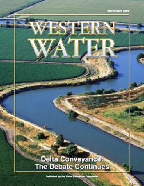
A recent court ruling may have thrown a wrench in the state’s
funding plans for the controversial and expensive Delta
Conveyance Project – a tunnel to move Sacramento River water 45
miles beneath the ecologically sensitive Sacramento-San Joaquin
Delta. In January, the Sacramento Superior Court denied
the state Department of Water Resources’ (DWR) request to
finance the project through bonds. Tunnel opponents hailed
the ruling as a blow to the project. But state staff say the
ruling will not impede funding. DWR has appealed the case and
is still planning on using bonds to pay for the project if it
comes to fruition.
Last year, Pacific Gas & Electric announced that it would
demolish the [Eel River's] Scott and Cape Horn dams and
decommission the entire Potter Valley power project.
… Removing the dams will help restore natural river
flows, which will improve fish habitat along the Eel River.
That’s been a longtime objective of the Round Valley Indian
Tribes. The tribes have strong historic and cultural ties to
the river and its bounty. When the dams come down, the Eel
River will become the longest free-flowing river in California
according to fish advocates. Salmon, steelhead and trout all
will benefit. Lake Pillsbury will disappear. Demolition is not
restoration, though, and there will be ripple effects on other
nearby natural areas.
Fishers are fighting tire companies’ attempt to dismiss an
Endangered Species Act suit over the use of a rubber additive
known as 6PPD, which harms salmon, telling a California federal
judge the companies are trying to delay accountability…
Two Tahoe towns are saying no to plastic water
bottles. South Lake Tahoe’s ban on single-use
plastic water bottles and paper cartons is slated to go into
full effect next month, soon after neighboring Truckee
passed an ordinance to implement a similar
ban. … The League to Save Lake Tahoe found that
single-use plastic bottles are one of the top five types of
litter in the Tahoe Basin, Truckee’s news release
states.
Southern California’s Imperial Irrigation District, which
supplies water to farmers who grow most of the nation’s winter
vegetables, planned to start a conservation program in April to
scale back what it draws from the critical Colorado River. But
a tiny, tough fish got in the way. Now, those plans won’t start
until at least June so water and wildlife officials can devise
a way to ensure the endangered desert pupfish and other species
are protected, said Jamie Asbury, the irrigation district’s
general manager.
Steelhead (Oncorhynchus mykiss) exhibit some of the most
diverse life history traits among all Pacific salmonid species
and play major cultural, economic, and recreational roles
throughout the Pacific Coast. Steelhead are unique from their
resident rainbow trout counterparts in that they follow an
anadromous life-history, meaning they migrate to the ocean as
juveniles and return to spawn in freshwater streams and rivers
as adults. Rainbow trout, on the other hand, remain in
freshwater streams for their entire life. Unlike most of their
Pacific salmonid cousins, steelhead are iteroparous, meaning
that they can spawn more than once in their lifetime. This
adaptation allows steelhead to have a more flexible lifecycle
that can be advantageous during warmer or drier seasons,
especially near the southern end of their distribution in
California’s Central Valley.
California State Parks’ Division of Boating and Waterways is
offering grant funding to prevent the further spread of quagga
and zebra mussels into California’s waterways. Funded by the
California Mussel Fee Sticker (also known as the Quagga
Sticker), the Quagga and Zebra Mussel (QZ) Infestation
Prevention Grant Program expects to award a total of up to $2
million across eligible applicants. Applications will be
accepted from Monday, April 1 through Friday, May 10, 2024.All
applications must be received by 5 p.m. on May 10, 2024. The QZ
grants are available to entities that own or manage any aspect
of water in a reservoir that is open for public recreation, is
mussel-free, and do not have an existing two-year QZ Grant
awarded in 2023.
A new research paper published recently in Annual Review of
Earth and Planetary Sciences, coordinated by scientists from
The University of New Mexico and collaborating institutions,
addresses the complex nature and societal importance of Grand
Canyon’s springs and groundwater. The paper,
“Hydrotectonics of Grand Canyon Groundwater,” recommends
sustainable groundwater management and uranium
mining threats that require better monitoring and
application of hydrotectonic concepts. The data suggest an
interconnectivity of the groundwater systems such that uranium
mining and other contaminants pose risks to people, aquifers,
and ecosystems. The conclusion based on multiple datasets is
that groundwater systems involve significant mixing.
A vast burn scar unfolds in drone footage of a landscape seared
by massive wildfires north of Lake Tahoe. But amid the expanses
of torched trees and gray soil, an unburnt island of lush green
emerges. The patch of greenery was painstakingly engineered. A
creek had been dammed, creating ponds that slowed the flow of
water so the surrounding earth had more time to sop it up. A
weblike system of canals helped spread that moisture through
the floodplain. Trees that had been encroaching on the wetlands
were felled. But it wasn’t a team of firefighters or
conservationists who performed this work. It was a crew of
semiaquatic rodents whose wetland-building skills have seen
them gain popularity as a natural way to mitigate
wildfires. A movement is afoot to restore beavers to the
state’s waterways, many of which have suffered from their
absence.
Today, legislation to protect California’s iconic salmon and
steelhead trout authored by Assemblymember Diane Papan (D-San
Mateo) was approved by the Assembly Committee on Transportation
with a bipartisan vote. The S.A.L.M.O.N Act (Stormwater
Anti-Lethal Measures for Our Natives Act), would mandate the
development and implementation of a regional strategy by the
Department of Transportation (Caltrans) to eliminate (a
contaminant from tire rubber) from stormwater discharges
into specified salmon and steelhead trout-bearing surface
waters of the state.
Near the California-Oregon border, reservoirs that once
submerged valleys have been drained, revealing a stark
landscape that had been underwater for generations. A thick
layer of muddy sediment covers the sloping ground, where
workers have been scattering seeds and leaving meandering
trails of footprints. In the cracked mud, seeds are sprouting
and tiny green shoots are appearing. With water passing freely
through tunnels in three dams, the Klamath River has returned
to its ancient channel and is flowing unhindered for the first
time in more than a century through miles of waterlogged lands.
Birds and people need clean and abundant water in rivers,
lakes, streams, wetlands, and marshes in landscapes throughout
the country. Today, the White House is announcing several
new initiatives to celebrate World Water Day and protect
waterways, and access to clean water, across the country.
… The announcements are paired with updates from
previous water-related commitments from the Administration,
including historic levels of Bipartisan Infrastructure Law
funding for conservation in places like the Everglades, the
Great Lakes, and the Delaware River basin, safeguarding
wilderness and cultural areas to protect them from pollution
and development, and building resilience to climate change in
places threatened by flooding, drought, and wildfires like the
Colorado River Basin.
Fresno’s largest body of water — and likely its most diverse
wildlife habitat — shimmers in silence on a sunny spring
afternoon. … Where we’re at is Milburn Pond, a reclaimed
gravel mining pit that belongs to the San Joaquin River
Ecological Reserve and is managed by the Department of Fish and
Wildlife. … Listed at 287 acres, Milburn Pond is large
enough to be considered a lake. Except for the fact that it’s
not surrounded by land on all sides. … Now, though,
there’s a state-approved proposal to isolate the pond that has
been kicking around since the historic 2006 settlement to
restore river flows and self-sustaining salmon runs. It’s a
plan Moosios and others believe would irreparably harm this
little-known or observed wildlife sanctuary — even though less
destructive and expensive options have been proposed that would
accomplish virtually the same stated purpose. -Written by columnist Marek Warszawski.
… Riparian forest is a rare sight in the Central Valley.
About one million acres of trees, shrubs, and grasses once
flourished, drowned, and flourished again along the valley’s
rivers, creeks, and floodplains; now, perhaps 130,000 acres
remain. In recent years, though, that number has begun to inch
up again. Caswell has about 260 acres. Seven miles south of
there is Dos Rios Ranch—2,100 acres, much of it former dairy
farm and almond orchard, at the extremely floodable confluence
of the Tuolumne and San Joaquin rivers—which is steadily being
restored to riparian forest. Later this year it will open as
California’s first new state park in 15 years.
In what has been a years-long fight to fend off efforts to mine
sites and areas the Quechan Indian Tribe say are culturally
significant, the tribe was victorious in preserving those sites
this week with an unexpected win against Canada’s SMP Gold
Corp. … The federally protected land, under the
U.S. Bureau of Land Management, is culturally significant and
important to the Quechan Indian Tribe and its members have been
vehemently fighting the Oro Cruz mining project for years, with
the support of other tribes, and numerous environmental and
social justice groups and concerned residents behind them.
… After the hearing, White elaborated further and told
the Calexico Chronicle that the tribe is trying to dedicate the
Cargo Muchacho Mountains area as the “Kw’tsán National
Monument”
Outrage over the Trump-packed U.S. Supreme Court rolling back
federal reproductive rights has in some ways overshadowed the
now 6-3 conservative majority’s relentless assault on
environmental regulations that for decades protected Colorado’s
clean air and water. … Now Colorado lawmakers are trying
to step into that regulatory void with Wednesday’s filing of
the Regulate Dredge and Fill Activities in State Waters bill
(HB24-1379). If passed, it would require a rulemaking process
by the Colorado Department of Health and Environment’s Water
Quality and Control Division to permit dredge and fill
activities on both public and private land. -Written by contributor David O. Williams.
Some of California’s most treasured parks are threatened by
blight caused by pollution and climate change, according to a
pair of new reports. The four national parks with the highest
ozone levels are all in California, with Sequoia and Kings
Canyon National Parks topping the list of parks struggling with
air that’s dangerous to breathe, according to a recent report
by the National Parks Conservation Assn., an independent
advocacy group. Meanwhile, severe wildfires, drought and
sea-level rise are ravaging state parks, which encompass nearly
a quarter of California’s coastline, according to a separate
report by the California State Parks Foundation, another
advocacy group. … Behemoth sequoias and jagged Joshua
trees are among millions of trees across the state
succumbing to worsening wildfires, severe drought, extreme
heat, disease and other stressors that have been intensified by
global warming.
California wineries appear to be complying with the Water
Board’s statewide Winery General Order’s winery wastewater
requirements, but the pace is slow, state statistics reveal.
And many are not in the compliance reporting pipeline at all,
data shows. (An overview page is provided here.) The order was
passed, the water boards said, for two major reasons. One was
because, “Winemakers requested the order to address the
statewide inconsistencies in permitting.” This request was from
large wineries that operate numerous facilities throughout the
state. (Smaller wineries opposed this in the public
hearings.) … As of Feb. 20, 2024, 201 wineries had
begun the process of filing, leaving a gap of 1,449 wineries
(the difference between 1,650 and 201, based on the initial
estimates).
A Sacramento judge upheld a decision by California’s water
regulator to cut back agricultural and municipal water use from
the San Joaquin River. The decision could lend support for
future regulations in the rest of the Sacramento-San Joaquin
River Delta system. It comes amid declining fish populations
and increasing pressure on water supply due to climate change.
But rather than move forward with strict regulations, the state
agency is considering a plan pushed by Gov. Gavin Newsom that
would grant water districts more flexibility.
A court has upheld a key decision by California’s water board
calling for reductions in water diversions from the San Joaquin
River and its tributaries to help revive struggling fish
populations. In his ruling, Sacramento County Superior Court
Judge Stephen Acquisto rejected lawsuits by water districts
serving farms and cities that would be required to take less
water under the standards adopted by regulators. The judge also
rejected challenges by environmental groups that had argued for
requiring larger cutbacks to boost river flows. The judge’s
ruling, issued in a 162-page order last week, supports the
State Water Resources Control Board’s 2018 adoption of a water
quality plan for the lower San Joaquin River and its three
major tributaries — the Tuolumne, Merced and Stanislaus rivers.
California’s Yurok Tribe, which had 90% of its territory taken
from it during the Gold Rush of the mid-1800s, will be getting
a slice of its land back to serve as a new gateway to Redwood
National and State Parks visited by 1 million people a year.
The Yurok will be the first Native people to manage tribal land
with the National Park Service under a historic memorandum of
understanding signed Tuesday. … Much of the property was
paved over by a lumber operation that worked there for 50 years
and also buried Prairie Creek, where salmon would swim upstream
from the Pacific to spawn. … The ’O Rew property represents
just a tiny fraction of the more than 500,000 acres of the
ancestral land of the Yurok, whose reservation straddles the
lower 44 miles of the Klamath River. The Yurok tribe is
also helping lead efforts in the largest dam removal
project in U.S. history along the California-Oregon border
to restore the Klamath and boost the salmon population.
Although pesticides can rid your home of cockroaches or farm
fields of unwanted insects, they also can harm fish and
potentially even people, according to a new study from Oregon
State University. At high concentrations, these commonly
used pyrethroid pesticides, bifenthrin, cyfluthrin and
cyhalothrin, act as a neurotoxin for pests. … At low
concentrations, the pyrethroid pesticides disrupt fish’s
endocrine system, which produces hormones. The scientists
wanted to better understand how short of an exposure would harm
fish.
You may have heard that various kinds of invasive plants and
animals create problems for species that are native to an area.
In the case of the quagga mussel, which only grows to the size
of a thumbnail, its effects extend beyond the natural ecology
and into the built environment. … Rick Boatner, the
invasive species coordinator for the Oregon Department of Fish
and Wildlife, says the invasive mussels are what’s known as
filter feeders. “They’re removing the lowest part of the food
web out of the water system, the phytoplankton and stuff like
that,” Boatner said. “So now you will not have the food needed
for our salmon fry and steelhead trout species…”
A network of artificial streams is teaching scientists how
California’s mountain waterways — and the ecosystems that
depend on them — may be impacted by a warmer, drier climate.
Over the next century, climate change is projected to bring
less snowfall to the Sierra Nevada. … In a new study,
University of California, Berkeley, researchers used a series
of nine artificial stream channels off Convict Creek in Mammoth
Lakes, California, to mimic the behavior of headwater streams
under present-day conditions and future climate change
scenarios.
California officials are trying to boost state wetlands
protections in order to guard against a 2023 Supreme Court
decision that slashed federal oversight of wetlands.
Assemblymember Laura Friedman’s A.B. 2875 would declare it the
state’s policy to ensure long-term gain and no net loss of
California’s wetlands. And Democratic Gov. Gavin Newsom’s
administration is proposing to add 38 new positions to enforce
the state’s existing wetlands protection laws and scrutinize
development permits.
Can Texas, New Mexico, and Colorado agree to a new
apportionment of the Rio Grande’s waters without the U.S.
government’s approval? The Supreme Court of the United States
is set to hear a case next week that may affect access to water
for millions of Americans — and set a precedent that could
impact millions more, as increased usage and climate change
further strain supply of the precious resource. … If
[the court sides with the states], the government might be
understood to have less weight to throw around in other
negotiations, such as the one that is also happening about the
Colorado River.
A state policy that seeks to protect California’s major rivers
and creeks by cracking down on how much water is pumped out by
cities and farms can move forward despite widespread
opposition, the Superior Court has ruled. The long-awaited
decision on what’s known as the Bay-Delta Plan denies 116
claims in a dozen separate lawsuits that seek to undo a 2018
update to the policy, most of which are from water agencies
saying the limits on their water draws go too far. The 160-page
verdict, released Friday by Sacramento County Judge Stephen
Acquisto, specifically notes that arguments made by San
Francisco against the regulation fell short.
After decades of advocating, tribal members cheered as a blast
at JC Boyle Dam this year kicked off the process of drawing
down the reservoirs behind three Klamath River dams. The
removal is expected to restore the river and reopen spawning
habitat that salmon haven’t been able to reach for more than a
century. OPB science reporter and editor Cassandra Profita
brings us the perspective of the tribes living along the
Klamath River: what the country’s largest dam removal project
means to them and their hopes for the future.
This half-hour special dives into the troubles and triumphs at
the Salton Sea. The sea is the largest body of water in
California. It formed after a levee at the Colorado River burst
in the early 1900s, and after the levee was fixed, it cut off
the flow of fresh water. Since then, the sea has become
polluted with chemical runoff from nearby farms. It’s also
slowly evaporating. The chemical-filled water releases gases
that trigger asthma in nearby communities, and toxic dust from
around the shoreline acts as an irritant as well. Despite
all of the negatives, there are a few positives. New wetlands
are forming as the sea slowly pulls away from the shoreline,
playing host to thousands of migrating birds. Developing
wetlands make the sea an important stop along the Pacific
Flyway.
A restoration project at Talbert Marsh got the go-ahead
Thursday after the state Coastal Commission approved a coastal
permit application submitted by the Huntington Beach Wetlands
Conservancy as part of its consent calendar. The roughly 25
acres of Talbert Marsh stretch between Brookhurst Street to the
Santa Ana River Trail and make up one of four wetlands the
nonprofit owns and maintains. More than 90 bird species have
been observed at the marsh in addition to the adjoining
wetlands, according to the organization. The project along the
southeastern and western shorelines of South Island will
address erosion, which Coastal Commission staff said causes the
disappearance of coastal salt marsh vegetation and depletes
refuge spaces for sensitive bird species that live there.
… A windswept county in the Sacramento Valley — whose
entire population of 22,000 people is just one-third of Palo
Alto’s — may soon be known for something else: the largest new
reservoir anywhere in California in the past 50 years. Last
weekend, President Biden signed a package of bills that
included $205 million in construction funding for Sites
Reservoir, a proposed $4.5 billion project planned for the
rolling ranchlands west of the town of Maxwell, about 70
miles north of Sacramento. … The make-or-break moment
for Sites is a series of hearings scheduled to run from June to
November in which the State Water Resources Control Board will
analyze fisheries studies and other documents and decide
whether to award it the water rights to move forward.
The Sacramento Superior Court has ruled in favor of the State
Water Board’s 2018 Bay Delta Plan update, denying all 116
claims by petitioners. In December 2018, the State Water
Resources Control Plan adopted revised flow
objectives for the San Joaquin River and its three major
tributaries, the Stanislaus, Tuolumne, and Merced rivers. The
new flow objectives provide for increased flows on the three
tributaries to help revive and protect native fall-run
migratory fish populations. The Board also adopted a revised
south Delta salinity objectives, increasing the level of
salinity allowed from April to August. Several petitions
were filed in several counties challenging the Board’s
action.
California environmental groups are urging a federal court to
intervene amid a “dramatic increase” in the deaths of
threatened steelhead trout at pumps operated by state and
federal water managers. Since Dec. 1, more than 4,000 wild and
hatchery-raised steelhead have been killed at pumps in the
Sacramento-San Joaquin River Delta, according to public data
for the State Water Project and the federal Central Valley
Project. The agencies are now at about 90% of their combined
seasonal take limit, which refers to the amount of wild
steelhead permitted to be killed between January and March
under the U.S. Endangered Species Act. A coalition of
environmental and fishing groups — including the Golden State
Salmon Assn., the Bay Institute and Defenders of Wildlife — are
involved in ongoing litigation that seeks to challenge current
federal operating plans in the delta, an estuary at the heart
of the state’s water supply.
The Biden administration will be allocating more than $120
million to tribal governments to fight the impacts of climate
change, the Department of the Interior announced Thursday. The
funding is designed to help tribal nations adapt to climate
threats, including relocating infrastructure. Indigenous
peoples in the U.S. are among the communities most affected by
severe climate-related environmental threats, which have
already negatively impacted water resources, ecosystems and
traditional food sources in Native communities in every corner
of the U.S. “As these communities face the increasing
threat of rising seas, coastal erosion, storm surges, raging
wildfires and devastation from other extreme weather events,
our focus must be on bolstering climate resilience …”
Interior Secretary Deb Haaland, a member of the Pueblo of
Laguna, said in a Wednesday press briefing.
Environmental groups on Thursday sued officials who signed off
on a lithium project in the Salton Sea that a top Biden
official has helped advance. Comité Civico del Valle and
Earthworks filed the legal complaint in Imperial County
Superior Court against county officials who approved
conditional permits for Controlled Thermal Resources’ Hell’s
Kitchen lithium and geothermal project. The groups argue that
the country’s approval of the direct lithium extraction and
geothermal brine project near the southeastern shore of the
Salton Sea violates county and state laws, such as the
California Environmental Quality Act.
Gavin Newsom’s stealthy divide and conquer tactics are pushing
marginalized communities against each other in a war over
water. Newsom, his administration and State Water Contractors
are appropriating environmental justice language to sway public
opinion in Southern California about the Delta Conveyance
Project – also referred to as the Delta tunnel. They argue that
the Delta tunnel is essential for Southern California’s
disadvantaged communities, yet misrepresent the harm the
project continues to have on the tribal communities along
California’s major rivers and on communities in the Delta
watershed. Pitting disadvantaged communities from different
regions of the state against each other is a cynical strategy,
and is all the more egregious when considering it’s done in the
interest of serving only one sector of California’s economy
that these players have deemed all-important – special
interests in Southern California and portions of Silicon
Valley. -Written by Barbara Barrigan-Parrilla, executive director
of Restore the Delta.
A dog-killing parasite that was believed to only exist in Texas
and other Gulf Coast states has been discovered as far west as
California for the first time, scientists have warned. Experts
at the University of California Riverside found the
Heterobilharzia americana parasite, a flatworm commonly known
as a liver fluke, in spots along the Colorado River where it
runs through Southern California. According to the university,
the flatworm has never before been seen outside of Texas and
surrounding areas, and other studies have found most infections
occur in Texas and Louisiana, though some have occurred in
North Carolina, Texas, and Kansas.
… For millennia seasonal wetlands dotted California’s Central
Valley … But as farms and towns have taken over the
landscape, nearly all those shallow, ephemeral water bodies
have disappeared, leaving avian migrants with scant options for
pit stops. With shorebirds rapidly declining along the Pacific
Flyway, conservationists and landowners have joined forces to
help turn the tide. Launched in
2014, BirdReturns runs via reverse auctions … Since
its inception, the program—jointly run by Audubon California,
The Nature Conservancy, and Point Blue Conservation Science—has
paid more than 100 farmers a total of $2 million to flood
60,000 acres throughout the Sacramento and San Joaquin valleys.
Buoyed by a recent $15 million grant from the state, the
program is poised to greatly expand its reach.
A new recommendation from the California State Water Quality
Control Board in its Bay-Delta Water Quality Control Plan
(Bay-Delta Plan) for the San Francisco Bay/Sacramento-San
Joaquin Delta Estuary could see Solano County forced to adapt
to a fraction of the water it is currently allocated from Lake
Berryessa. The implications for Solano County cities could be
enormous, leaving Solano County with about 25 percent of its
current allocation. Spanning hundreds of miles from north of
Lake Shasta to Fresno, the tributaries of the Sacramento and
Sac Joaquin rivers that feed into the San Francisco Bay reach
well into the Sierra Nevadas and Central Valley. The State
Water Quality Control Board has noted that diminished river
flows in these areas are harming fish habitats and are
detrimental to the water system as a whole ecologically.
California State Parks’ Division of Boating and Waterways (DBW)
today announced the availability of grant funding to prevent
the further spread of quagga and zebra mussels into
California’s waterways. Funded by the California Mussel Fee
Sticker (also known as the Quagga Sticker), the Quagga and
Zebra Mussel (QZ) Infestation Prevention Grant Program expects
to award a total of up to $2 million across eligible
applicants.
A rusty red color in Lake Merritt that left lake stewards
scrambling to sample the water on Mar. 7 has tested positive
for the same algae that caused the devastating harmful algal
bloom in 2022. On Friday, lake stewards sent water
samples to labs run by the California Department of Public
Health and San Francisco Bay Regional Water Control Board.
Unofficial field testing initially detected no harmful algae.
However, lab testing confirmed over the weekend the presence of
Heterosigma akashiwo, a type of algae often associated with
harmful blooms. Harmful algal blooms, or HABs, occur when
certain types of algae grow rapidly and release toxins, lower
oxygen levels, and cause other changes in water quality that
can kill fish and other marine creatures.
A dozen tire companies are asking a California federal judge to
toss a suit claiming a rubber additive is harming protected
salmon, arguing that the litigation stretches the Endangered
Species Act “beyond its breaking point” and that regulation of
the substance belongs with the U.S. Environmental Protection
Agency, not in courts.
Giant sequoia trees, imported to the UK 160 years ago, are
flourishing despite the dramatically different climate to their
native California, a new study has found. The huge trees, which
are declining in numbers in California due to increasing heat,
are now adapting well to the UK’s climate and growing taller, a
study conducted by UCL researchers says. “The growth here
in the UK seems to be suited to our wetter climate, so there’s
far less chance of water stress here than in the Sierras in
California,” lead author of the study and professor of
geogrpahy, Mat Disney, told The Independent.
Just south of Dos Rios Ranch, a much-praised effort at river
restoration, another such project is taking root. It will add
about 380 acres of floodplain and other habitat to the 1,600
acres at Dos Rios. They are near the confluence of the Tuolumne
and San Joaquin rivers, about eight miles southwest of Modesto.
The state-funded project, totaling about $20.8 million, is on
the former Hidden Valley Dairy. Annual feed crops are giving
way to oaks, cottonwoods, willows and other native plants. The
floodplain will take on high river flows that otherwise could
threaten nearby Grayson and downstream towns. The standing
water could recharge the aquifer below for use during droughts.
The place could offer food and shelter to fish, birds, mammals
and other creatures.
California has set ambitious climate goals, including phasing
out the use of fossil fuels and becoming carbon neutral by
2045. Our guest today is here to talk about the role nature can
play in meeting those goals. Laurie Wayburn is the co-founder
and president of the Pacific Forest Trust and the chair of the
California Natural and Working Lands Expert Advisory Committee.
She was also the lead author of a recent report suggesting the
state should invest “as much in nature-based climate solutions
as it has in clean energy and transportation.” With proper
forest management, California could capture 400 million tons of
carbon each year, lower wildfire risk and vastly improve flood
protection in the state.
This month, several wildlife conservation groups petitioned the
California Fish and Game Commission to list these owls as
endangered or threatened under the California Endangered
Species Act. … [Chair of the environmental studies department
at San Jose State University Lynne] Trulio’s speciality is
urban species, and she’s contributed to the research that
underpins Santa Clara County’s habitat conservation plan on
burrowing owls. But before that she was also the lead scientist
for the South Bay Salt Pond Restoration Project, one of
the largest tidal wetland restoration projects on the West
Coast. “One of the things that drove the effort was the
fact that there were endangered species” in wetlands, said
Trulio. She said it took years to change the perception of the
wetlands as a dumping ground and to get a ballot measure to
fund its preservation.
California’s fishing industry is bracing for another bad year
as federal managers today announced plans to heavily restrict
or prohibit salmon fishing again, after cancelling the entire
season last year. The Pacific Fishery Management Council
today released a series of options that are under
consideration, all of which either ban commercial and
recreational salmon fishing in the ocean off California or
shorten the season and set strict catch limits. The council’s
decision is expected next month; the commercial season
typically begins in May and ends in October. … [P]opulations
are now a fraction of what they once were — dams have
blocked vital habitat, while droughts and water diversions have
driven down flows and increased temperatures, killing large
numbers of salmon eggs and young fish.
California officials are preparing new urban water conservation
rules intended to help the state adapt to a drier future caused
by climate change. In reality, the proposed restrictions are so
great they could actually harm those adaptation efforts by
sacrificing the tree canopy we have nurtured in our cities for
generations. The “Making Conservation a California Way of Life”
rule package, proposed by the State Water Resources Control
Board, sets conservation targets unique to each urban water
agency in the state. While conserving each and every year makes
sense, so must the restrictions. A recent report by the
non-partisan Legislative Analyst’s Office found big flaws in
the Water Board’s approach, describing the proposal as overly
complex, expensive and unrealistic, with potential water
savings amounting to a mere drop in the bucket statewide. -Written by Jim Peifer, executive director of the
Sacramento Regional Water Authority; and Victoria
Vasquez, grants and public policy manager
for California ReLeaf, which works to protect, enhance and
grow California’s urban and community forests.
On March 6, a coalition of environmental and fishing groups
reiterated their request that a federal court modify federal
agencies’ proposed interim plan for operating the federal
Central Valley Project (CVP), in coordination with the State
Water Project (SWP), to protect fish species listed under the
Endangered Species Act (ESA) and California Endangered Species
Act (CESA). That coalition includes the Pacific Coast
Federation of Fishermen’s Associations, the Golden State Salmon
Association, The Bay Institute, Defenders of Wildlife, and
Natural Resources Defense Council. Coinciding with that filing
has been a recent dramatic increase of protected steelhead
dying at the projects’ water pumps. The CVP and SWP are
still largely operating under rules written in 2019 under the
leadership of, among others, Interior Secretary David
Bernhardt, a former lobbyist for the powerful Westlands Water
District.
In 2012, one of the driest years in Colorado in recent memory,
the Crystal River practically dried up. Ken Neubecker, a
now-retired Colorado projects director at environmental group
American Rivers and former member of the Pitkin County Healthy
Rivers board, recalls the stream conditions. … These
extremely low-water conditions returned in the drought years of
2018, 2020 and 2021, with river flows near the fish hatchery
just south of Carbondale hovering around 8 to 10 cfs — not
enough to support aquatic life and nowhere near the 100 cfs
that the state of Colorado says is the minimum needed to
maintain a healthy stream.
… Los Angeles desperately needs to become more like a
sponge. That will help to capture more stormwater locally when
rain does come and lessen devastating flooding, said Edith de
Guzman, a UCLA water equity and climate adaptation researcher.
… The Rory M. Shaw Wetlands Park Project will
turn a 46-acre landfill formerly used for materials such as
concrete and gravel into an engineered wetland that can boost
local water supply and alleviate local flooding. It’ll also
become a 15-acre park with a lake and walking paths.
… But now, the biggest barrier to completing the project
is funding, said Mark Pestrella, the director of L.A. County
Department of Public Works, which is spearheading the project
(after it’s constructed, the city of L.A. will take over
maintenance). The new goal is to complete it by 2028 or 2029.
In January, draining the reservoirs behind the Klamath Dams
began. Iron Gate Reservoir, Copco Lake, and the Boyle Reservoir
are now largely empty as blasts opened holes in culverts
beneath Copco #1 and the John C. Boyle dams and the outlet
tunnel below Iron Gate was opened. “The Klamath River flows
free,” ran some headlines. Well not exactly. Keno and Link
River dams in Oregon upstream near Klamath Falls will not be
removed. Iron Gate, Copco #1, and J.C. Boyle still stand,
although the reservoirs behind them are largely empty. Until
the dams are completely removed (slated for this
spring/summer), the flow is still impacted by the dam
structures, causing erosion and ponding. Constriction and
acceleration as the water flows through narrowed passageways
can lead to cavitation. Cavitation occurs when irregularities
in the bed lift the water. The resulting negative pressure
causes bubbles of water vapor to form. -Written by Lori Dengler, an emeritus professor of
geology at Cal Poly Humboldt.
Countries, regions, and river basins globally are struggling to
provide and manage flows in rivers for ecosystems. One
approach, of many, is a Functional Flows approach, because it
seeks to provide a range of streamflows over the year and
between years to support fundamental functions of river
ecosystems and the ecosystem services for society. … The
approach also involves a process for balancing multiple human
and ecological objectives for river systems through broad
engagement of multiple interests. In their challenge to
maintain riverine ecosystem services, Chile and California can
benefit from this dynamic approach to managing instream flows.
The State Water Resources Control Board is exploring regulating
nutrients emitted from Southern California wastewater treatment
plants into the ocean. The controversial move is prompted by
concerns that these discharges may accelerate acidification and
oxygen loss in the region’s coastal waters, harming nearshore
marine life. The wastewater treatment industry says this
nutrient regulation is premature. Environmentalists say it’s
overdue. … Wastewater effluent from 23 million
people is piped offshore in Southern California. The resulting
acidity boost could be enough to start dissolving the shells of
crabs and small snails called pteropods, which swim near the
ocean surface and are a favorite food of many fish and whales.
And the resulting oxygen depletion could deprive anchovies,
which many commercial fish eat, of their habitat.
Sea otters, once hunted to near extinction, are staging a
comeback in California. Their return has revealed the
incredible positive effects these furry apex predators can have
on the state’s coastal ecosystems, including kelp forests and
seagrass meadows. Now, there’s another coastal ecosystem to add
to that list, one that plays an important role in bank
stabilization, water filtration, and carbon storage: the salt
marsh. In a new study in Nature, researchers found that sea
otters have reduced bank erosion rates by 69% in Elkhorn
Slough, a coastal wetland south of San Francisco, in the
decades since their return to the estuary. Their big effect is
due to their big appetites—the Elkhorn Slough salt marsh has
been eroding, in part, because of root-munching shore crabs
that burrow into the soil and destabilize the banks.
The State Water Resources Control Board received a letter from
the California Department of Fish and Wildlife (CDFW)
submitting instream flow recommendations to inform a long-term
flow-setting process to support anadromous salmonids and
year-round ecological stream function on Mill, Deer, and
Antelope Creeks. Mill, Deer, and Antelope Creeks are
tributaries to the Sacramento River and provide aquatic habitat
for several native fish species including Chinook salmon
(spring-run, fall-run, and late fall-run), Steelhead, and
Pacific Lamprey. Additional information will be forthcoming on
the next steps in considering the recommendations. Additional
information related to this matter can be found on the Mill,
Deer, and Antelope Creeks – Flow Recommendations webpage.
This tour explored the Sacramento River and its tributaries through a scenic landscape while learning about the issues associated with a key source for the state’s water supply.
All together, the river and its tributaries supply 35 percent of California’s water and feed into two major projects: the State Water Project and the federal Central Valley Project.
Water Education Foundation
2151 River Plaza Drive, Suite 205
Sacramento, CA 95833
This tour explored the Sacramento River and its tributaries
through a scenic landscape while learning about the issues
associated with a key source for the state’s water supply.
All together, the river and its tributaries supply 35 percent of
California’s water and feed into two major projects: the State
Water Project and the federal Central Valley Project.
Water Education Foundation
2151 River Plaza Drive, Suite 205
Sacramento, CA 95833
Biologists have designed a variety
of unique experiments in the past decade to demonstrate the
benefits that floodplains provide for small fish. Tracking
studies have used acoustic tags to show that chinook salmon
smolts with access to inundated fields are more likely than their
river-bound cohorts to reach the Pacific Ocean. This is because
the richness of floodplains offers a vital buffet of nourishment
on which young salmon can capitalize, supercharging their growth
and leading to bigger, stronger smolts.
Water is flowing once again
to the Colorado River’s delta in Mexico, a vast region that
was once a natural splendor before the iconic Western river was
dammed and diverted at the turn of the last century, essentially
turning the delta into a desert.
In 2012, the idea emerged that water could be intentionally sent
down the river to inundate the delta floodplain and regenerate
native cottonwood and willow trees, even in an overallocated
river system. Ultimately, dedicated flows of river water were
brokered under cooperative
efforts by the U.S. and Mexican governments.
State work to improve wildlife habitat and tamp down dust at California’s ailing Salton Sea is finally moving forward. Now the sea may be on the verge of getting the vital ingredient needed to supercharge those restoration efforts – money.
The shrinking desert lake has long been a trouble spot beset by rising salinity and unhealthy, lung-irritating dust blowing from its increasingly exposed bed. It shadows discussions of how to address the Colorado River’s two-decade-long drought because of its connection to the system. The lake is a festering health hazard to nearby residents, many of them impoverished, who struggle with elevated asthma risk as dust rises from the sea’s receding shoreline.
This tour guided participants on a virtual exploration of the Sacramento River and its tributaries and learn about the issues associated with a key source for the state’s water supply.
All together, the river and its tributaries supply 35 percent of California’s water and feed into two major projects: the State Water Project and the federal Central Valley Project.
Radically transformed from its ancient origin as a vast tidal-influenced freshwater marsh, the Sacramento-San Joaquin Delta ecosystem is in constant flux, influenced by factors within the estuary itself and the massive watersheds that drain though it into the Pacific Ocean.
Lately, however, scientists say the rate of change has kicked into overdrive, fueled in part by climate change, and is limiting the ability of science and Delta water managers to keep up. The rapid pace of upheaval demands a new way of conducting science and managing water in the troubled estuary.
Out of sight and out of mind to most
people, the Salton Sea in California’s far southeast corner has
challenged policymakers and local agencies alike to save the
desert lake from becoming a fetid, hyper-saline water body
inhospitable to wildlife and surrounded by clouds of choking
dust.
The sea’s problems stretch beyond its boundaries in Imperial and
Riverside counties and threaten to undermine multistate
management of the Colorado River. A 2019 Drought Contingency Plan for the
Lower Colorado River Basin was briefly stalled when the Imperial
Irrigation District, holding the river’s largest water
allocation, balked at participating in the plan because, the
district said, it ignored the problems of the Salton Sea.
Deep, throaty cadenced calls —
sounding like an off-key bassoon — echo over the grasslands,
farmers’ fields and wetlands starting in late September of each
year. They mark the annual return of sandhill cranes to the
Cosumnes River Preserve,
46,000 acres located 20 miles south of Sacramento on the edge of
the Sacramento-San Joaquin Delta.
High in the headwaters of the Colorado River, around the hamlet of Kremmling, Colorado, generations of families have made ranching and farming a way of life, their hay fields and cattle sustained by the river’s flow. But as more water was pulled from the river and sent over the Continental Divide to meet the needs of Denver and other cities on the Front Range, less was left behind to meet the needs of ranchers and fish.
“What used to be a very large river that inundated the land has really become a trickle,” said Mely Whiting, Colorado counsel for Trout Unlimited. “We estimate that 70 percent of the flow on an annual average goes across the Continental Divide and never comes back.”
One of California Gov. Gavin
Newsom’s first actions after taking office was to appoint Wade
Crowfoot as Natural Resources Agency secretary. Then, within
weeks, the governor laid out an ambitious water agenda that
Crowfoot, 45, is now charged with executing.
That agenda includes the governor’s desire for a “fresh approach”
on water, scaling back the conveyance plan in the Sacramento-San
Joaquin Delta and calling for more water recycling, expanded
floodplains in the Central Valley and more groundwater recharge.
Bruce Babbitt, the former Arizona
governor and secretary of the Interior, has been a thoughtful,
provocative and sometimes forceful voice in some of the most
high-profile water conflicts over the last 40 years, including
groundwater management in Arizona and the reduction of
California’s take of the Colorado River. In 2016, former
California Gov. Jerry Brown named Babbitt as a special adviser to
work on matters relating to the Sacramento-San Joaquin Delta and
the Delta tunnels plan.
For the bulk of her career, Jayne
Harkins has devoted her energy to issues associated with the
management of the Colorado River, both with the U.S. Bureau of
Reclamation and with the Colorado River Commission of Nevada.
Now her career is taking a different direction. Harkins, 58, was
appointed by President Trump last August to take the helm of the
United States section of the U.S.-Mexico agency that oversees
myriad water matters between the two countries as they seek to
sustainably manage the supply and water quality of the Colorado
River, including its once-thriving Delta in Mexico, and other
rivers the two countries share. She is the first woman to be
named the U.S. Commissioner of the International Boundary and
Water Commission for either the United States or Mexico in the
commission’s 129-year history.
The growing leadership of women in water. The Colorado River’s persistent drought and efforts to sign off on a plan to avert worse shortfalls of water from the river. And in California’s Central Valley, promising solutions to vexing water resource challenges.
These were among the topics that Western Water news explored in 2018.
We’re already planning a full slate of stories for 2019. You can sign up here to be alerted when new stories are published. In the meantime, take a look at what we dove into in 2018:
In the universe of California water, Tim Quinn is a professor emeritus. Quinn has seen — and been a key player in — a lot of major California water issues since he began his water career 40 years ago as a young economist with the Rand Corporation, then later as deputy general manager with the Metropolitan Water District of Southern California, and finally as executive director of the Association of California Water Agencies. In December, the 66-year-old will retire from ACWA.
In 1983, a landmark California Supreme Court ruling extended the public trust doctrine to tributary creeks that feed Mono Lake, which is a navigable water body even though the creeks themselves were not. The ruling marked a dramatic shift in water law and forced Los Angeles to cut back its take of water from those creeks in the Eastern Sierra to preserve the lake.
Now, a state appellate court has for the first time extended that same public trust doctrine to groundwater that feeds a navigable river, in this case the Scott River flowing through a picturesque valley of farms and alfalfa in Siskiyou County in the northern reaches of California.
This tour explored the Sacramento River and its tributaries
through a scenic landscape as participants learned about the
issues associated with a key source for the state’s water supply.
All together, the river and its tributaries supply 35 percent of
California’s water and feed into two major projects: the State
Water Project and the federal Central Valley Project. Tour
participants got an on-site update of Oroville Dam spillway
repairs.
There’s going to be a new governor
in California next year – and a host of challenges both old and
new involving the state’s most vital natural resource, water.
So what should be the next governor’s water priorities?
That was one of the questions put to more than 150 participants
during a wrap-up session at the end of the Water Education
Foundation’s Sept. 20 Water Summit in Sacramento.
Water means life for all the Grand Canyon’s inhabitants, including the many varieties of insects that are a foundation of the ecosystem’s food web. But hydropower operations upstream on the Colorado River at Glen Canyon Dam, in Northern Arizona near the Utah border, disrupt the natural pace of insect reproduction as the river rises and falls, sometimes dramatically. Eggs deposited at the river’s edge are often left high and dry and their loss directly affects available food for endangered fish such as the humpback chub.
An hour’s drive north of Sacramento sits a picture-perfect valley hugging the eastern foothills of Northern California’s Coast Range, with golden hills framing grasslands mostly used for cattle grazing.
Back in the late 1800s, pioneer John Sites built his ranch there and a small township, now gone, bore his name. Today, the community of a handful of families and ranchers still maintains a proud heritage.
Farmers in the Central Valley are broiling about California’s plan to increase flows in the Sacramento and San Joaquin river systems to help struggling salmon runs avoid extinction. But in one corner of the fertile breadbasket, River Garden Farms is taking part in some extraordinary efforts to provide the embattled fish with refuge from predators and enough food to eat.
And while there is no direct benefit to one farm’s voluntary actions, the belief is what’s good for the fish is good for the farmers.
For more than 100 years, invasive
species have made the Sacramento-San Joaquin Delta their home,
disrupting the ecosystem and costing millions of dollars annually
in remediation.
The latest invader is the nutria, a large rodent native to South
America that causes concern because of its propensity to devour
every bit of vegetation in sight and destabilize levees by
burrowing into them. Wildlife officials are trapping the animal
and trying to learn the extent of its infestation.
Deep, throaty cadenced calls —
sounding like an off-key bassoon — echo over the grasslands,
farmers’ fields and wetlands starting in late September of each
year. They mark the annual return of sandhill cranes to the
Cosumnes River Preserve,
46,000 acres located 20 miles south of Sacramento on the edge of
the Sacramento-San Joaquin Delta.
As we continue forging ahead in 2018
with our online version of Western Water after 40 years
as a print magazine, we turned our attention to a topic that also
got its start this year: recreational marijuana as a legal use.
State regulators, in the last few years, already had been beefing
up their workforce to tackle the glut in marijuana crops and
combat their impacts to water quality and supply for people, fish
and farming downstream. Thus, even if these impacts were perhaps
unbeknownst to the majority of Californians who approved
Proposition 64 in 2016, we thought it important to see if
anything new had evolved from a water perspective now that
marijuana was legal.
California voters may experience a sense of déjà vu this year when they are asked twice in the same year to consider water bonds — one in June, the other headed to the November ballot.
Both tackle a variety of water issues, from helping disadvantaged communities get clean drinking water to making flood management improvements. But they avoid more controversial proposals, such as new surface storage, and they propose to do some very different things to appeal to different constituencies.
Along the banks of the
Sacramento-San Joaquin Delta in Oakley, about 50 miles southwest
of Sacramento, is a park that harkens back to the days when the
Delta lured Native Americans, Spanish explorers, French fur
trappers, and later farmers to its abundant wildlife and rich
soil.
That historical Delta was an enormous marsh linked to the two
freshwater rivers entering from the north and south, and tidal
flows coming from the San Francisco Bay. After the Gold Rush,
settlers began building levees and farms, changing the landscape
and altering the habitat.
Despite the heat that often
accompanies debates over setting aside water for the environment,
there are instances where California stakeholders have forged
agreements to provide guaranteed water for fish. Here are two
examples cited by the Public Policy Institute of California in
its report arguing for an environmental water right.
Does California need to revamp the way in which water is dedicated to the environment to better protect fish and the ecosystem at large? In the hypersensitive world of California water, where differences over who gets what can result in epic legislative and legal battles, the idea sparks a combination of fear, uncertainty and promise.
Saying that the way California manages water for the environment “isn’t working for anyone,” the Public Policy Institute of California (PPIC) shook things up late last year by proposing a redesigned regulatory system featuring what they described as water ecosystem plans and water budgets with allocations set aside for the environment.
This tour explored the Sacramento River and its tributaries
through a scenic landscape as participants learned about the
issues associated with a key source for the state’s water supply.
All together, the river and its tributaries supply 35 percent of
California’s water and feed into two major projects: the State
Water Project and the federal Central Valley Project. Tour
participants got an on-site update of repair efforts on the
Oroville Dam spillway.
Estuaries are places where fresh and
salt water mix, usually at the point where a river enters the
ocean. They are the meeting point between riverine environments
and the sea, with a combination of tides, waves, salinity, fresh
water flow and sediment. The constant churning means there are
elevated levels of nutrients, making estuaries highly productive
natural habitats.
Zooplankton, which are floating
aquatic microorganisms too small and weak to swim against
currents, are are important food sources for many fish species in
the Delta such as salmon, sturgeon and Delta smelt.
A tributary is a river or stream
that enters a larger body of water, especially a lake or river.
The receiving water into which a tributary
feeds is called the “mainstem,” and the point where they come
together is referred to as the “confluence.”
With a holding capacity of more than 260 billion gallons, Diamond
Valley Lake is
Southern California’s largest reservoir. It sits about 90
miles southeast of Los Angeles and just west of Hemet in
Riverside County where it was built in 2000. The offstream
reservoir was created by three large dams that connect the surrounding
hills, costing around $1.9 billion and doubling the region’s
water storage capacity.
Headwaters are the source of a
stream or river. They are located at the furthest point from
where the water body empties or merges with
another. Two-thirds of California’s surface water supply
originates in these mountainous and typically forested regions.
In wet years, dry years and every type of water year in between,
the daily intrusion and retreat of salinity in the Sacramento-San
Joaquin Delta is a constant pattern.
The cycle of ebb and flood is the defining nature of an estuary
and prior to its transformation into an agricultural tract in
the mid-19th century, the Delta was a freshwater marsh with
plants, birds, fish and wildlife that thrived on the edge of the
saltwater/freshwater interface.
This 28-page report describes the watersheds of the Sierra Nevada
region and details their importance to California’s overall water
picture. It describes the region’s issues and challenges,
including healthy forests, catastrophic fire, recreational
impacts, climate change, development and land use.
The report also discusses the importance of protecting and
restoring watersheds in order to retain water quality and enhance
quantity. Examples and case studies are included.
20-minute version of the 2012 documentary The Klamath Basin: A
Restoration for the Ages. This DVD is ideal for showing at
community forums and speaking engagements to help the public
understand the complex issues related to complex water management
disputes in the Klamath River Basin. Narrated by actress Frances
Fisher.
For over a century, the Klamath River Basin along the Oregon and
California border has faced complex water management disputes. As
relayed in this 2012, 60-minute public television documentary
narrated by actress Frances Fisher, the water interests range
from the Tribes near the river, to energy producer PacifiCorp,
farmers, municipalities, commercial fishermen, environmentalists
– all bearing legitimate arguments for how to manage the water.
After years of fighting, a groundbreaking compromise may soon
settle the battles with two epic agreements that hold the promise
of peace and fish for the watershed. View an excerpt from the
documentary here.
This 25-minute documentary-style DVD, developed in partnership
with the California Department of Water Resources, provides an
excellent overview of climate change and how it is already
affecting California. The DVD also explains what scientists
anticipate in the future related to sea level rise and
precipitation/runoff changes and explores the efforts that are
underway to plan and adapt to climate.
30-minute DVD that traces the history of the U.S. Bureau of
Reclamation and its role in the development of the West. Includes
extensive historic footage of farming and the construction of
dams and other water projects, and discusses historic and modern
day issues.
California’s little-known New River has been called one of North
America’s most polluted. A closer look reveals the New River is
full of ironic twists: its pollution has long defied cleanup, yet
even in its degraded condition, the river is important to the
border economies of Mexicali and the Imperial Valley and a
lifeline that helps sustain the fragile Salton Sea ecosystem.
Now, after decades of inertia on its pollution problems, the New
River has emerged as an important test of binational cooperation
on border water issues. These issues were profiled in the 2004
PBS documentary Two Sides of a River.
This beautiful 24×36 inch poster, suitable for framing, features
a map of the San Joaquin River. The map text focuses on the San
Joaquin River Restoration Program, which aims to restore flows
and populations of Chinook salmon to the river below Friant Dam
to its confluence with the Merced River. The text discusses the
history of the program, its goals and ongoing challenges with
implementation.
This beautiful 24×36 inch poster, suitable for framing, displays
the rivers, lakes and reservoirs, irrigated farmland, urban areas
and Indian reservations within the Klamath River Watershed. The
map text explains the many issues facing this vast,
15,000-square-mile watershed, including fish restoration;
agricultural water use; and wetlands. Also included are
descriptions of the separate, but linked, Klamath Basin
Restoration Agreement and the Klamath Hydroelectric Agreement,
and the next steps associated with those agreements. Development
of the map was funded by a grant from the U.S. Fish and Wildlife
Service.
A companion to the Truckee River Basin Map poster, this 24×36
inch poster, suitable for framing, explores the Carson River, and
its link to the Truckee River. The map includes Lahontan Dam and
Reservoir, the Carson Sink, and the farming areas in the basin.
Map text discusses the region’s hydrology and geography, the
Newlands Project, land and water use within the basin and
wetlands. Development of the map was funded by a grant from the
U.S. Bureau of Reclamation Mid-Pacific Region, Lahontan Basin
Area Office.
This 24×36 inch poster, suitable for framing, explains how
non-native invasive animals can alter the natural ecosystem,
leading to the demise of native animals. “Unwelcome Visitors”
features photos and information on four such species – including
the zerbra mussel – and explains the environmental and economic
threats posed by these species.
The 28-page Layperson’s Guide to Water Rights Law, recognized as
the most thorough explanation of California water rights law
available to non-lawyers, traces the authority for water flowing
in a stream or reservoir, from a faucet or into an irrigation
ditch through the complex web of California water rights.
The Water Education Foundation’s second edition of
the Layperson’s Guide to The Klamath River Basin is
hot off the press and available for purchase.
Updated and redesigned, the easy-to-read overview covers the
history of the region’s tribal, agricultural and environmental
relationships with one of the West’s largest rivers — and a
vast watershed that hosts one of the nation’s oldest and
largest reclamation projects.
The 24-page Layperson’s Guide to the Delta explores the competing
uses and demands on California’s Sacramento-San Joaquin Delta.
Included in the guide are sections on the history of the Delta,
its role in the state’s water system, and its many complex issues
with sections on water quality, levees, salinity and agricultural
drainage, fish and wildlife, and water distribution.
As part of the historic Colorado
River Delta, the Salton Sea regularly filled and dried for
thousands of years due to its elevation of 237 feet below
sea level.
The Pacific Flyway is one of four
major North American migration routes for birds, especially
waterfowl, and extends from Alaska and Canada, through
California, to Mexico and South America. Each year, birds follow
ancestral patterns as they travel the flyway on their annual
north-south migration. Along the way, they need stopover sites
such as wetlands with suitable habitat and food supplies. In
California, 90 percent of historic wetlands have been lost.
The construction of Glen Canyon Dam
in 1964 created Lake Powell. Both are located in north-central
Arizona near the Utah border. Lake Powell acts as a holding tank
for outflow from the Colorado River Upper Basin States: Colorado,
New Mexico, Utah and Wyoming.
The water stored in Lake Powell is used for recreation, power
generation and delivering water to the Lower Basin states of
California, Arizona, and Nevada.
This issue of Western Water looks at the BDCP and the
Coalition to Support Delta Projects, issues that are aimed at
improving the health and safety of the Delta while solidifying
California’s long-term water supply reliability.
This printed issue of Western Water examines the issues
associated with the State Water Board’s proposed revision of the
water quality Bay-Delta Plan, most notably the question of
whether additional flows are needed for the system, and how they
might be provided.
This printed issue of Western Water examines science –
the answers it can provide to help guide management decisions in
the Delta and the inherent uncertainty it holds that can make
moving forward such a tenuous task.
This printed issue of Western Water provides an overview of the
idea of a dual conveyance facility, including questions
surrounding its cost, operation and governance
This printed copy of Western Water examines the native salmon and
trout dilemma – the extent of the crisis, its potential impact on
water deliveries and the lengths to which combined efforts can
help restore threatened and endangered species.
This printed copy of Western Water examines the Colorado River
Delta, its ecological significance and the lengths to which
international, state and local efforts are targeted and achieving
environmental restoration while recognizing the needs of the
entire river’s many users.
In the world of water, biology and engineering often clash -
especially when it comes to resolving the Delta dilemma. How do
we manage such an altered system to ensure water supply
reliability while restoring the ecosystem? How do we measure the
results of efforts to restore endangered species and habitat? Why
is biodiversity important?
Balance between ecosystem restoration and water supply
reliability is key to a Bay-Delta solution. Everyone agrees on
this concept. But the demands of the competing interests can tilt
the scales. So, too, can the member agencies’ conflicting
missions. For more than three years, the joint state-federal
CALFED Bay-Delta Program has been searching for equilibrium among
the Delta’s complex problems and its contentious stakeholders. In
December, it released its latest blueprint for resolving the
Delta dilemma — the Revised Phase II Report.


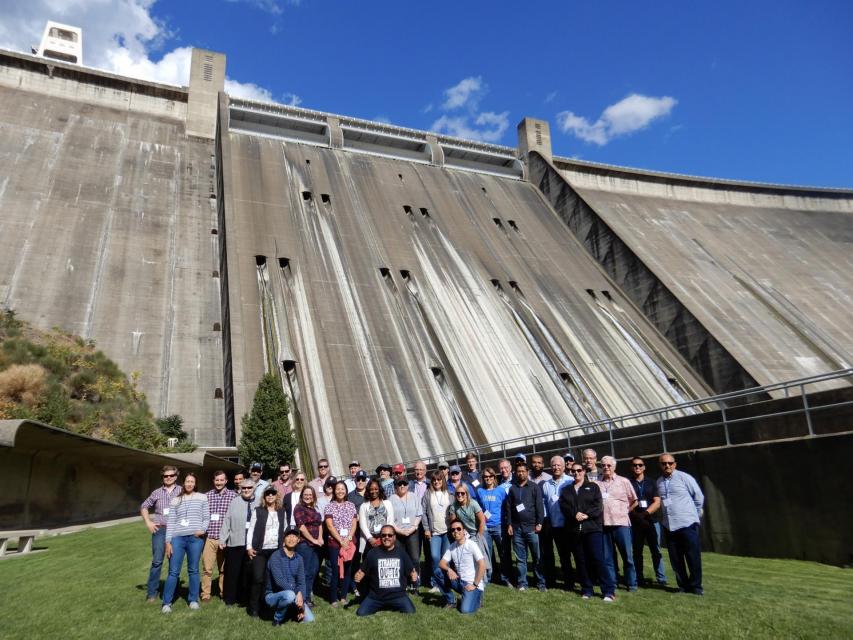


")
")
")
")
")
")
")
")
")
: Karla Nemeth, director, California Department of Water Resources; Gloria Gray, chair, Metropolitan Water District of Southern California; Brenda Burman, Bureau of Reclamation Commissioner; Jayne Harkins, commissioner, International Boundary and Water Commission, U.S. and Mexico; Amy Haas, executive director, Upper Colorado River Commission.")
")
")

")
")
")
")
")